
IMAGES TAKEN NEAR TO
Brick Terrace, HEREFORD, HR2 0DH
Introduction
This page details the photographs taken nearby to Brick Terrace, HR2 0DH by members of the Geograph project.
The Geograph project started in 2005 with the aim of publishing, organising and preserving representative images for every square kilometre of Great Britain, Ireland and the Isle of Man.

There are currently over 7.5m images from over14,400 individuals and you can help contribute to the project by visiting https://www.geograph.org.uk
Image Map
Images are licensed for reuse under creativecommons.org/licenses/by-sa/2.0
Notes
- Clicking on the map will re-center to the selected point.
- The higher the marker number, the further away the image location is from the centre of the postcode.
Image Listing (63 Images Found)
Images are licensed for reuse under creativecommons.org/licenses/by-sa/2.0
Image
Details
Distance
1
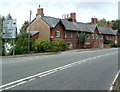
Distances from Pontrilas
This view across the A465 shows a choice of nine destinations, with distances in miles.
The houses are in Brickyard Row. http://www.geograph.org.uk/photo/2593367
Image: © Jaggery
Taken: 6 Sep 2011
0.00 miles
2
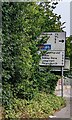
Distances from Pontrilas, Herefordshire
Located 1½ (miles) from Kentchurch, 2½ from Grosmont, 5 from Orcop, 6 from Garway (all to the right) and 1 from Ewyas Harold, 2 from Dulas, 3 from Abbey Dore, 6 from Longtown and 9 from Peterchurch (all to the left), the sign at the A465 junction is partly obscured by vegetation in September 2022.
Image: © Jaggery
Taken: 11 Sep 2022
0.03 miles
3
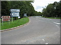
Road junction at Pontrilas
Road junction on the A465 at Pontrilas.
Image: © Philip Halling
Taken: 18 Sep 2010
0.04 miles
4
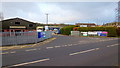
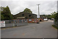
Westwood Industrial Estate, Pontrilas
A range of small businesses and light industry.
Image: © Jonathan Billinger
Taken: 21 Jan 2012
0.05 miles
5
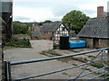
Pontrilas Court Farm buildings
Viewed from the Pontrilas side of the B4347, the road to Kentchurch.
Image: © Jaggery
Taken: 9 Sep 2011
0.05 miles
6
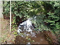
River Dore, Pontrilas
Maps shows that Dulas Brook joins the River Dore nearby, but a fallen leafy branch obscures the view. The Dore is a tributary of the Monnow. The name Dore is probably derived from the Welsh word for water, dŵr, but was interpreted by the Normans as d'or or doré, French for golden. This misunderstanding led to the river's valley becoming known in English as 'Golden Valley'.
Image: © Jaggery
Taken: 6 Sep 2011
0.05 miles
8
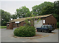
Golden Valley Rewinds
Servicing and repair of electric motors.
Image: © Hugh Venables
Taken: 18 Aug 2018
0.06 miles
9
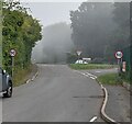
50 mph speed limit signs, Pontrilas, Herefordshire
A direction sign on a grass triangle in the background shows Rowlestone 1½ (miles).
Image: © Jaggery
Taken: 11 Sep 2022
0.06 miles
10
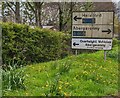
Faded directions sign alongside the B4347, Ewyas Harold
Faded in April 2023, the sign is on the approach to the A465 junction.
Image: © Jaggery
Taken: 23 Apr 2023
0.06 miles