
IMAGES TAKEN NEAR TO
Cherry Hill Rise, HR1 4FQ
Introduction
This page details the photographs taken nearby to Cherry Hill Rise, HR1 4FQ by members of the Geograph project.
The Geograph project started in 2005 with the aim of publishing, organising and preserving representative images for every square kilometre of Great Britain, Ireland and the Isle of Man.

There are currently over 7.5m images from over14,400 individuals and you can help contribute to the project by visiting https://www.geograph.org.uk
Image Map
Images are licensed for reuse under creativecommons.org/licenses/by-sa/2.0
Notes
- Clicking on the map will re-center to the selected point.
- The higher the marker number, the further away the image location is from the centre of the postcode.
Image Listing (56 Images Found)
Images are licensed for reuse under creativecommons.org/licenses/by-sa/2.0
Image
Details
Distance
1
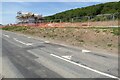
Building site at Fownhope
The first houses in under construction on this building site beside the B4224 on the northern edge of the village of Fownhope. I previously photographed this site in October last year.
Image: © Philip Halling
Taken: 16 Jul 2022
0.00 miles
2
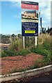
Cherry Hill information board, Fownhope, Herefordshire
Freeman Homes board alongside the B4224 near this https://www.geograph.org.uk/photo/7540316 construction site in July 2023.
Image: © Jaggery
Taken: 9 Jul 2023
0.02 miles
3
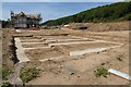
House foundations
House foundations on a construction site on the northern edge of Fownhope.
Image: © Philip Halling
Taken: 16 Jul 2022
0.02 miles
4
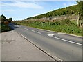
The B4224 north of Fownhope
The B4224 north of Fownhope. The land on the right behind the heras fencing is being prepared for building.
Image: © Philip Halling
Taken: 10 Oct 2021
0.03 miles
5
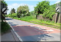
End of the 30 zone at the NW edge of Fownhope
The 30mph speed limit on the B4224 increases to the National Speed Limit.
Viewed from the corner of Lower House Gardens.
Image: © Jaggery
Taken: 29 May 2016
0.04 miles
6
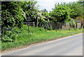
Fownhope boundary sign and speed limit sign
The inconspicuous FOWNHOPE sign on the left contrasts with the unmissable speed limit sign http://www.geograph.org.uk/photo/4970750 on the right. Fownhope is a village in Herefordshire. Its population on the day of the 2011 Census was 999. The village website states that the name Fownhope is derived from Old English. It means valley of the flag (or possibly variegated valley).
Image: © Jaggery
Taken: 29 May 2016
0.04 miles
7
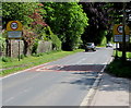
Start of the 30 zone at the NW edge of Fownhope
The National Speed Limit on the B4224 drops to 30mph in Fownhope, a village
in Herefordshire. Its population on the day of the 2011 Census was 999.
The village website states that the name Fownhope is derived from Old English.
It means valley of the flag (or possibly variegated valley).
Image: © Jaggery
Taken: 29 May 2016
0.04 miles
8
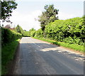
Hedge-lined B4224 NW of Fownhope
The B4224 heads away from Fownhope towards Mordiford.
Image: © Jaggery
Taken: 29 May 2016
0.04 miles
9
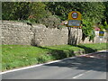
Entering Fownhope
Traffic from the Hereford road, B4224, is required to slow down through the village. Parked cars further on provide an element of calming.
Image: © David M Clark
Taken: 23 Aug 2014
0.05 miles
10
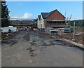
Fenced-off construction site, Fownhope, Herefordshire
The Freeman Homes Cherry Hill https://www.geograph.org.uk/photo/7540320 development of 2- 3- 4- and 5-bedroom
houses at the NW edge of Fownhope viewed from the B4224 in July 2023.
Image: © Jaggery
Taken: 9 Jul 2023
0.07 miles