
IMAGES TAKEN NEAR TO
Munstone, HEREFORD, HR1 3AJ
Introduction
This page details the photographs taken nearby to HR1 3AJ by members of the Geograph project.
The Geograph project started in 2005 with the aim of publishing, organising and preserving representative images for every square kilometre of Great Britain, Ireland and the Isle of Man.

There are currently over 7.5m images from over14,400 individuals and you can help contribute to the project by visiting https://www.geograph.org.uk
Image Map
Images are licensed for reuse under creativecommons.org/licenses/by-sa/2.0
Notes
- Clicking on the map will re-center to the selected point.
- The higher the marker number, the further away the image location is from the centre of the postcode.
Image Listing (23 Images Found)
Images are licensed for reuse under creativecommons.org/licenses/by-sa/2.0
Image
Details
Distance
1
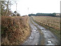
Along the lane from Munstone to Ivydene
The view from the Munstone end along a 100-metre long hedged and fenced lane to a house, Ivydene.
Image: © Jaggery
Taken: 13 Jan 2011
0.06 miles
2
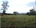
Field adjacent to White House Farm, Lyde Cross
The view SE from a field adjoining farm buildings. http://www.geograph.org.uk/photo/2259126
Image: © Jaggery
Taken: 13 Jan 2011
0.08 miles
3
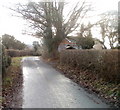
Bend in road to Munstone
The road from Lyde Cross to Munstone bends past a tree and the house behind it, Hillcroft.
Image: © Jaggery
Taken: 13 Jan 2011
0.13 miles
4
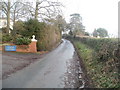
Shelwick Road heads away from Munstone
The road to Shelwick heads away from Munstone crossroads http://www.geograph.org.uk/photo/2259011 past the entrance drive http://www.geograph.org.uk/photo/2259024 to Munstone House Country Hotel.
Image: © Jaggery
Taken: 13 Jan 2011
0.14 miles
5
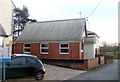
Former Munstone Evangelical Free Church
Shown on maps as Munstone Evangelical Free Church. There was no indication at the site that it is still in use as a church, so I assume it has been converted to a private residence.
Munstone is a small village in the parish of Holmer, located north of the city of Hereford.
Image: © Jaggery
Taken: 13 Jan 2011
0.15 miles
6
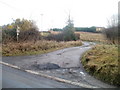
Munstone : lane to Ivydene
A lane heads east away from the road through the central area of the village of Munstone.
Image: © Jaggery
Taken: 13 Jan 2011
0.15 miles
7
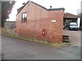
Postbox in the wall of Tabeel House, Munstone
The Edward VII postbox http://www.geograph.org.uk/photo/2259159 is vivid red, recently repainted.
Image: © Jaggery
Taken: 13 Jan 2011
0.15 miles
8
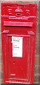
Edward VII postbox, Tabeel House, Munstone
The postbox is in the wall of Tabeel House. http://www.geograph.org.uk/photo/2259154
Image: © Jaggery
Taken: 13 Jan 2011
0.15 miles
9
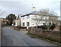
Chapel House, Munstone
House located next to the former Munstone Evangelical Free Church. http://www.geograph.org.uk/photo/2259041
Image: © Jaggery
Taken: 13 Jan 2011
0.15 miles
10
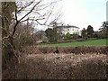
Munstone
A bigger example of the scattering of houses around a crossroads just north of Hereford.
Image: © Richard Webb
Taken: 1 Apr 2006
0.15 miles