
IMAGES TAKEN NEAR TO
Catherine Court, Catherine Street, HEREFORD, HR1 2DG
Introduction
This page details the photographs taken nearby to Catherine Court, Catherine Street, HR1 2DG by members of the Geograph project.
The Geograph project started in 2005 with the aim of publishing, organising and preserving representative images for every square kilometre of Great Britain, Ireland and the Isle of Man.

There are currently over 7.5m images from over14,400 individuals and you can help contribute to the project by visiting https://www.geograph.org.uk
Image Map
Images are licensed for reuse under creativecommons.org/licenses/by-sa/2.0
Notes
- Clicking on the map will re-center to the selected point.
- The higher the marker number, the further away the image location is from the centre of the postcode.
Image Listing (1197 Images Found)
Images are licensed for reuse under creativecommons.org/licenses/by-sa/2.0
Image
Details
Distance
1
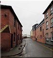
West along Catherine Street, Hereford
From the corner of Monkmoor Street.
Image: © Jaggery
Taken: 30 Jan 2017
0.02 miles
2
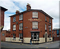
Nell Gwynne, Monkmoor Street, Hereford
Victorian pub with a rounded corner into Catherine Street. Dated 1862.
Image: © Stephen Richards
Taken: 12 Aug 2013
0.03 miles
3
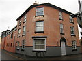
Nell Gwynne (Hereford)
Now converted into housing, this used to be a pub dedicated to Nell Gwynne.
Quite surprised that this viewpoint looks similar to Jaggery's photograph of the same building. https://www.geograph.org.uk/photo/5274853
Image: © Fabian Musto
Taken: 10 Mar 2018
0.03 miles
4
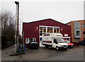
Philip Morris & Son van in the Goods In area, Hereford
Viewed across Coningsby Street. Text on the side of the van includes
Philip Morris & Son The home & country department store 18 & 23 Widemarsh Street Hereford.
Image: © Jaggery
Taken: 30 Jan 2017
0.03 miles
5
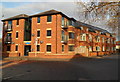
Charles Court flats, Hereford
Located on the corner of Coningsby Street and Canal Road.
Image: © Jaggery
Taken: 13 Jan 2012
0.03 miles
6
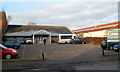
Canal Road Day Centre, Hereford
Herefordshire Council premises located on the west side of Canal Road in central Hereford, about 150 metres north of Commercial Road.
The day centre has services and facilities designed to help physically or mentally impaired adults remain in the community. It also provides carers the opportunity to have a break from their caring role.
Overnight frost remains on the lower part of the roof.
Image: © Jaggery
Taken: 13 Jan 2012
0.03 miles
7
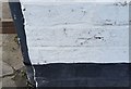
Ordnance Survey Cut Mark
This OS cut mark can be found on the Bicycle Shop, Coningsby Street. It marks a point 55.428m above mean sea level.
Image: © Adrian Dust
Taken: 10 Mar 2019
0.03 miles
8
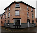
Former Nell Gwynne pub, Hereford
Viewed in January 2017. This is the former Nell Gwynne pub, seen here http://www.geograph.org.uk/photo/2765302 five years earlier.
Image: © Jaggery
Taken: 30 Jan 2017
0.03 miles
9
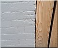
Ordnance Survey Cut Mark
This OS cut mark can be found on the former British Oak Public House. It marks a point 55.233m above mean sea level.
Image: © Adrian Dust
Taken: 10 Mar 2019
0.04 miles
10
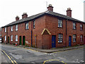
3-5 Monkmoor Street, Hereford
Modest but pleasant little brick houses, with nos. 40-42 Catherine Street on the right, by solid local architect Herbert Skyrme, 1907. The corner is corbelled.
Image: © Stephen Richards
Taken: 12 Aug 2013
0.04 miles