IMAGES TAKEN NEAR TO
Knotty Green, BEACONSFIELD, HP9 2TY
Introduction
This page details the photographs taken nearby to HP9 2TY by members of the Geograph project.
The Geograph project started in 2005 with the aim of publishing, organising and preserving representative images for every square kilometre of Great Britain, Ireland and the Isle of Man.

There are currently over 7.5m images from over14,400 individuals and you can help contribute to the project by visiting https://www.geograph.org.uk
Image Map
Images are licensed for reuse under creativecommons.org/licenses/by-sa/2.0
Notes
- Clicking on the map will re-center to the selected point.
- The higher the marker number, the further away the image location is from the centre of the postcode.
Image Listing (4 Images Found)
Images are licensed for reuse under creativecommons.org/licenses/by-sa/2.0
Image
Details
Distance
1
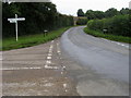
Crossroads of Penn Bottom Lane
Crossroads of Penn Bottom Lane and Clay Street
Image: © Shaun Ferguson
Taken: 7 Sep 2008
0.20 miles
2
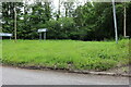
Clay Street at the junction of Penn Road
Image: © David Howard
Taken: 24 Jun 2021
0.22 miles
3
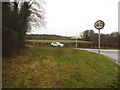
Marrod's Bottom at the junction of Clay Street
Image: © David Howard
Taken: 27 Jan 2018
0.22 miles
4
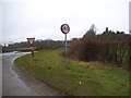
Marrod's Bottom at the junction of Horsemoor Lane
Image: © David Howard
Taken: 27 Jan 2018
0.24 miles