IMAGES TAKEN NEAR TO
Campbell Drive, BEACONSFIELD, HP9 1TF
Introduction
This page details the photographs taken nearby to Campbell Drive, HP9 1TF by members of the Geograph project.
The Geograph project started in 2005 with the aim of publishing, organising and preserving representative images for every square kilometre of Great Britain, Ireland and the Isle of Man.

There are currently over 7.5m images from over14,400 individuals and you can help contribute to the project by visiting https://www.geograph.org.uk
Image Map
Images are licensed for reuse under creativecommons.org/licenses/by-sa/2.0
Notes
- Clicking on the map will re-center to the selected point.
- The higher the marker number, the further away the image location is from the centre of the postcode.
Image Listing (16 Images Found)
Images are licensed for reuse under creativecommons.org/licenses/by-sa/2.0
Image
Details
Distance
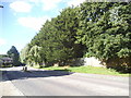
3
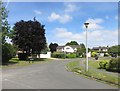
Knotty Green
The green, the Red Lion pub and the B474.
Image: © Andrew Smith
Taken: 9 Apr 2006
0.13 miles
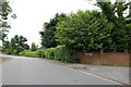
4
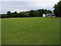
Knotty Green Cricket Club
Knotty Green Cricket Club by Forty Green Road
Image: © Shaun Ferguson
Taken: 13 Jun 2008
0.13 miles
9
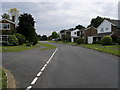
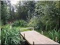
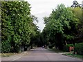
Seeleys Road
Seeleys Road passing Hoe Meadow
Image: © Shaun Ferguson
Taken: 13 Jun 2008
0.18 miles
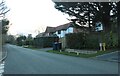
10
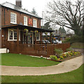
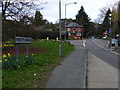
The Red Lion Knotty Green pub
Pub dating back to at least 1753
Image: © Tina
Taken: 19 Jan 2008
0.19 miles