IMAGES TAKEN NEAR TO
Upper Riding, BEACONSFIELD, HP9 1BJ

Introduction

This page details the photographs taken nearby to Upper Riding, HP9 1BJ by members of the Geograph project.

The Geograph project started in 2005 with the aim of publishing, organising and preserving representative images for every square kilometre of Great Britain, Ireland and the Isle of Man.

There are currently over 7.5m images from over14,400 individuals and you can help contribute to the project by visiting https://www.geograph.org.uk

Image Map


Images are licensed for reuse under creativecommons.org/licenses/by-sa/2.0
Notes
  • Clicking on the map will re-center to the selected point.
  • The higher the marker number, the further away the image location is from the centre of the postcode.

Image Listing (14 Images Found)

Images are licensed for reuse under creativecommons.org/licenses/by-sa/2.0
Image
Details
Distance
1
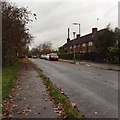
Cherry Tree Road
A typical view of housing on Cherry Tree Road.
Image: © Class 1 Taken: 5 Nov 2015
0.11 miles
2
Holtspur Top Lane
Image: © Alex McGregor Taken: 12 Feb 2014
0.12 miles
3
Holtspur Top Lane
A lot of Beaconsfield is fairly flat, but on the western side of town the contours close up a bit and it's more obvious that we are in the Chiltern Hills.
Image: © Des Blenkinsopp Taken: 18 Jun 2015
0.14 miles
4
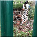
Holtspur Hilton minibeast hotel
Taken from outside the fence looking into the school field.
Image: © Class 1 Taken: 5 Nov 2015
0.16 miles
5
Holtspur Pre-School
Photo of front of building, taken through the gate.
Image: © Class 1 Taken: 5 Nov 2015
0.17 miles
6
Field of horses
Image: © Alex McGregor Taken: 12 Feb 2014
0.18 miles
7
Riding Lane
Image: © Alex McGregor Taken: 12 Feb 2014
0.19 miles
8
Holtspur United Reformed Church
Image: © Class 1 Taken: 5 Nov 2015
0.20 miles
9
Holtspur Top Lane
Holtspur Top Lane heading to Gregories Road
Image: © Shaun Ferguson Taken: 13 Jun 2008
0.20 miles
10
Farmland near Beaconsfield
Holtspur Bottom Farm is seen to the left.
Image: © David Purchase Taken: 10 Apr 2015
0.21 miles