IMAGES TAKEN NEAR TO
Vache Lane, CHALFONT ST. GILES, HP8 4SD
Introduction
This page details the photographs taken nearby to Vache Lane, HP8 4SD by members of the Geograph project.
The Geograph project started in 2005 with the aim of publishing, organising and preserving representative images for every square kilometre of Great Britain, Ireland and the Isle of Man.

There are currently over 7.5m images from over14,400 individuals and you can help contribute to the project by visiting https://www.geograph.org.uk
Image Map
Images are licensed for reuse under creativecommons.org/licenses/by-sa/2.0
Notes
- Clicking on the map will re-center to the selected point.
- The higher the marker number, the further away the image location is from the centre of the postcode.
Image Listing (13 Images Found)
Images are licensed for reuse under creativecommons.org/licenses/by-sa/2.0
Image
Details
Distance
1
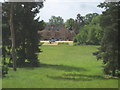
Chalfont St Giles: The Vache
This is the view of the east wing of The Vache from the top of Image
Image: © Nigel Cox
Taken: 22 May 2011
0.11 miles
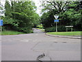
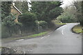
3
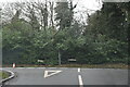
Gorelands Lane, Nightingales Lane junction
Image: © N Chadwick
Taken: 4 Jan 2021
0.17 miles
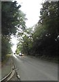
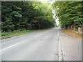
4
Nightingales Lane
Nightingales Lane nearing the left turn of Gorelands Lane
Image: © Shaun Ferguson
Taken: 29 Nov 2008
0.18 miles
5
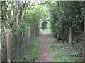
Chalfont St Giles: Permissive footpath to the Captain Cook Monument
Although the monument Image is in the private grounds of The Vache estate there is a permissive footpath to the tower, about 800 metres long, accessed by walking up the main driveway to the house from the B4442 Vache Lane, then striking off to the left over a stile at a set of gates with a green sign. This footpath takes one through a wood known as the Reservoir Plantation around the west side of the main house of the estate, and this is one of the views along the path.
Please note that permission to use the footpath may be withdrawn at any time.
Image: © Nigel Cox
Taken: 22 May 2011
0.20 miles
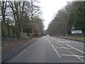
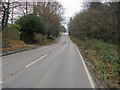
10
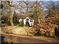
King's Road byway, Chalfont St Giles
This short stretch continuing King's Road is a public byway. Photo from Gorlands Lane.
Image: © David Hawgood
Taken: 17 Feb 2006
0.21 miles