IMAGES TAKEN NEAR TO
Bottrells Lane, CHALFONT ST. GILES, HP8 4EQ
Introduction
This page details the photographs taken nearby to Bottrells Lane, HP8 4EQ by members of the Geograph project.
The Geograph project started in 2005 with the aim of publishing, organising and preserving representative images for every square kilometre of Great Britain, Ireland and the Isle of Man.

There are currently over 7.5m images from over14,400 individuals and you can help contribute to the project by visiting https://www.geograph.org.uk
Image Map
Images are licensed for reuse under creativecommons.org/licenses/by-sa/2.0
Notes
- Clicking on the map will re-center to the selected point.
- The higher the marker number, the further away the image location is from the centre of the postcode.
Image Listing (13 Images Found)
Images are licensed for reuse under creativecommons.org/licenses/by-sa/2.0
Image
Details
Distance
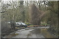
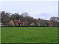
3
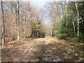
Hodgemoor Woods
Public woodland also with public footpaths.
Image: © Robin Webster
Taken: 27 Mar 2015
0.05 miles
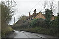
5
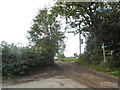
Track off Bottrells Lane, Chalfont St Giles
Image: © David Howard
Taken: 8 Oct 2015
0.07 miles
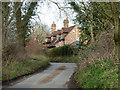
6
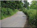
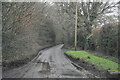
Bottrells Lane
Bottrells Lane by Eastern edge of Hodgemoor Woods heading to Chalfont St Giles
Image: © Shaun Ferguson
Taken: 13 Jun 2008
0.07 miles
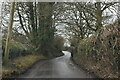
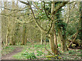
10
Hodgemoor Wood
The wood is owned by the Forestry Commission. This is the footpath at the eastern end.
Image: © Andrew Smith
Taken: 9 Apr 2006
0.15 miles