IMAGES TAKEN NEAR TO
Eagle Close, AMERSHAM, HP6 6TD
Introduction
This page details the photographs taken nearby to Eagle Close, HP6 6TD by members of the Geograph project.
The Geograph project started in 2005 with the aim of publishing, organising and preserving representative images for every square kilometre of Great Britain, Ireland and the Isle of Man.

There are currently over 7.5m images from over14,400 individuals and you can help contribute to the project by visiting https://www.geograph.org.uk
Image Map
Images are licensed for reuse under creativecommons.org/licenses/by-sa/2.0
Notes
- Clicking on the map will re-center to the selected point.
- The higher the marker number, the further away the image location is from the centre of the postcode.
Image Listing (14 Images Found)
Images are licensed for reuse under creativecommons.org/licenses/by-sa/2.0
Image
Details
Distance
1
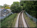
Metropolitan Line heading to Chesham
Under the Raans Road bridge the Metropolitan Line heading to Chesham
Image: © Shaun Ferguson
Taken: 3 Oct 2008
0.07 miles
3
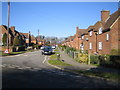
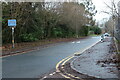
Amersham: Roundwood Road
Viewed looking north westwards from the junction with Grove Road.
Image: © Nigel Cox
Taken: 4 Mar 2006
0.19 miles
4
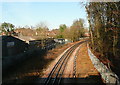
Line to Chesham
This is one of the outposts of the London underground, the Metropolitan Line branch line to Chesham. Although single track it does now have through trains from Central London.
Image: © Graham Horn
Taken: 16 Jan 2012
0.19 miles
6
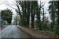
Raans Road, Amersham
The bridge across the Metropolitan Line
Image: © David Howard
Taken: 24 Dec 2022
0.20 miles
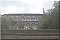
8
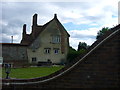
Raans Farmhouse
Ranns Farmhouse dates from the 16th Century and is built on the site of the older 12th century Raans Manor, believed to be the oldest manor in Amersham. This manor and farm played an important role in the history of Amersham Common and controlled much of the land around here, including most of the area which is now Amersham-on-the-Hill, and the land through which the railway passes. Over the years it has been owned by many powerful families including the de Mandevilles, the Duke of Bedford and Lord Chesham. The name seems to derive from the Jordan de Rane and his descendants, firstly under-tenants of Geoffrey de Mandeville 2nd Earl of Essex from 1166 and later owners until the late 14th Century.
Image: © Sean Davis
Taken: 22 May 2009
0.21 miles
9
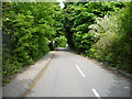
Raan's Lane
Raans Lane leading up from Amersham, over the railways and to Raans Farm. On the route of the London Green Belt Way.
Image: © Sean Davis
Taken: 22 May 2009
0.21 miles
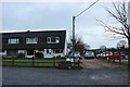
10
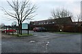
Raans Barns, Amersham
Part of the Raans Farm estate
Image: © David Howard
Taken: 24 Dec 2022
0.21 miles