1
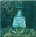
Chesham Road, Berkhamsted
Image: © John Baker
Taken: 10 Oct 2010
0.07 miles
2
Butts Meadow, Berkhamsted
It derives its name from the time when longbowmen practised at the butts and was given to the town by Mrs Lionel Lucas. It will be interesting to see how the growth of the sapling changes the view in the future.
Image: © John Baker
Taken: 10 Oct 2010
0.08 miles
3
Butts Meadow, Berkhamsted
Image: © Robert Eva
Taken: 24 Jun 2017
0.10 miles
4
Butts Meadow, Berkhamsted
The field derives its name from the time when longbowmen practised at the butts. It was given to the town by Mrs Lionel Lucas.
Image: © John Baker
Taken: 10 Oct 2010
0.11 miles
5
St Peter's Church Cemetery, Berkhamsted in 1966
This view shows St Peter's church tower, Berkhamsted Collegiate School and the motte of Berkhamsted Castle's keep.
Image: © John Baker
Taken: Unknown
0.12 miles
6
Berkhamsted: Dean Incent's House
This was the house in the High Street where John Incent, Dean of St Paul's Cathedral, and founder of Berkhamsted School in 1541, lived. Incent was born c 1480 and died in 1545.
Image: © Nigel Cox
Taken: 21 Oct 2007
0.13 miles
7
Footpath between Butts Meadow & Berkhamsted School playing field
The large building visible over the hedge is an extension that is under construction to the preparatory building of Berkhamsted School. Before it became a collegiate school, this was known as Berkhamsted School for Girls.
Image: © John Baker
Taken: 10 Oct 2010
0.13 miles
8
Prince Edward Street, Berkhamsted in 1966
The higher building on the left was the previous home of Berkhamsted library before it was moved to its present location in Upper Kings Road.
Image: © John Baker
Taken: Unknown
0.13 miles
9
Prince Edward Street, Berkhamsted
This street was formerly called Snob's Alley. It still bears a rather run-down appearance as it did in 1966 see http://www.geograph.org.uk/photo/1763981
Image: © John Baker
Taken: 10 Oct 2010
0.13 miles
10
St Peter's Church Cemetery, Berkhamsted in 1966
The inscription on this memorial reads Janet Lawson Baker passed on 19 October 1933 also her husband George Washington Baker 9 September 1960 reunited. They were my paternal grandparents. Janet was born in 1870 and George on 7 November 1873.
Image: © John Baker
Taken: Unknown
0.13 miles


