IMAGES TAKEN NEAR TO
Hall Park Gate, BERKHAMSTED, HP4 2NJ
Introduction
This page details the photographs taken nearby to Hall Park Gate, HP4 2NJ by members of the Geograph project.
The Geograph project started in 2005 with the aim of publishing, organising and preserving representative images for every square kilometre of Great Britain, Ireland and the Isle of Man.

There are currently over 7.5m images from over14,400 individuals and you can help contribute to the project by visiting https://www.geograph.org.uk
Image Map
Images are licensed for reuse under creativecommons.org/licenses/by-sa/2.0
Notes
- Clicking on the map will re-center to the selected point.
- The higher the marker number, the further away the image location is from the centre of the postcode.
Image Listing (34 Images Found)
Images are licensed for reuse under creativecommons.org/licenses/by-sa/2.0
Image
Details
Distance
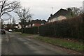
2
Garden Field Lane, Berkhamsted
Garden Field Lane marks the eastern edge of the built-up area of Berkhamsted south of the A4251 (formerly the A41). At first it is drivable, but as the houses on the right-hand side peter out, so the lane becomes narrower until it turns into a footpath. This footpath continues to Long Green, an area of woodland alongside the (comparatively) new A41 bypass. A path can then be taken southwards on the other side of the A41 towards Bottom Farm which is on the very western edge of this square. Another path strikes off to the west through Long Green and meets up with Swing Gate Lane.
Image: © Rob Farrow
Taken: 14 Aug 2006
0.11 miles
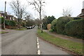
3
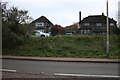
Houses on London Road, Berkhamsted
It shows how much changes in a short period of time. In 2019 the house on the left had chimneys and there was a large fir tree in front of the other one.
Image: © David Howard
Taken: 19 Nov 2022
0.13 miles
4
Grand Union Canal, Bank Mill Lane, Bourne End
Just the canal in a rural setting.
Image: © Jack Hill
Taken: 25 Aug 2005
0.17 miles
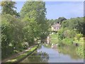
5
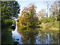
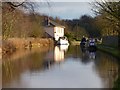
Grand Union Canal in Berkhamsted
The Bank Mill road bridge is just visible in the distance above the moored boat.
Image: © Nigel Cox
Taken: 21 Oct 2007
0.17 miles
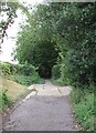
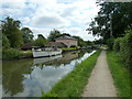
7
Approaching Lock 56, east of Berkhamsted
Image: © John Slater
Taken: 27 Mar 2017
0.20 miles
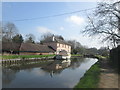
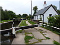
8
Pink House at top lock
Lovely boat and house at Bourne End top lock no56.
Image: © Malcolm Campbell
Taken: 30 Jul 2011
0.20 miles
9
The Grand Union Canal, Berkhamsted
Looking towards the house at Bourne End Top Lock.
Image: © Andrew Smith
Taken: 28 Jan 2012
0.20 miles
10
Cottage next to Top Side Lock No 56
Along the Grand Union Canal near Berkhamsted.
Image: © Mat Fascione
Taken: 18 Aug 2015
0.20 miles