IMAGES TAKEN NEAR TO
St. Margarets Close, BERKHAMSTED, HP4 2LH
Introduction
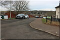
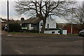
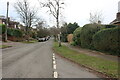
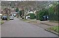
This page details the photographs taken nearby to St. Margarets Close, HP4 2LH by members of the Geograph project.
The Geograph project started in 2005 with the aim of publishing, organising and preserving representative images for every square kilometre of Great Britain, Ireland and the Isle of Man.

There are currently over 7.5m images from over14,400 individuals and you can help contribute to the project by visiting https://www.geograph.org.uk
Image Map
Images are licensed for reuse under creativecommons.org/licenses/by-sa/2.0
Notes
- Clicking on the map will re-center to the selected point.
- The higher the marker number, the further away the image location is from the centre of the postcode.
Image Listing (21 Images Found)
Images are licensed for reuse under creativecommons.org/licenses/by-sa/2.0
Image
Details
Distance
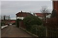
4
Berkhamsted
Upper Hall Park, with Buncefield still burning several miles to the East
Image: © Ian Rob
Taken: 12 Dec 2005
0.13 miles
6
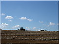
Berkhamsted
Field off Swing Gate Lane looking South
Image: © Ian Rob
Taken: 27 Aug 2005
0.14 miles