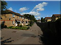
IMAGES TAKEN NEAR TO
Belswains Lane, HEMEL HEMPSTEAD, HP3 9XA
Introduction
This page details the photographs taken nearby to Belswains Lane, HP3 9XA by members of the Geograph project.
The Geograph project started in 2005 with the aim of publishing, organising and preserving representative images for every square kilometre of Great Britain, Ireland and the Isle of Man.

There are currently over 7.5m images from over14,400 individuals and you can help contribute to the project by visiting https://www.geograph.org.uk
Image Map
Images are licensed for reuse under creativecommons.org/licenses/by-sa/2.0
Notes
- Clicking on the map will re-center to the selected point.
- The higher the marker number, the further away the image location is from the centre of the postcode.
Image Listing (72 Images Found)
Images are licensed for reuse under creativecommons.org/licenses/by-sa/2.0
Image
Details
Distance
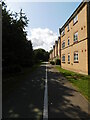
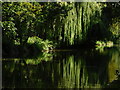
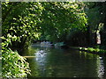
4
Dickinson Quay, Apsley
Looking towards Belswains Lane from Evans Wharf.
Image: © Richard Vince
Taken: 19 Sep 2015
0.11 miles
8
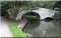
Apsley End Bridge No 154
Crossing the Grand Union Canal in Hemel Hempstead.
Image: © Mat Fascione
Taken: 18 Aug 2015
0.12 miles
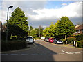
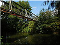
10
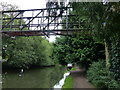
Pipebridge across the Grand Union Canal in Hemel Hempstead
Image: © Mat Fascione
Taken: 18 Aug 2015
0.12 miles