IMAGES TAKEN NEAR TO
London Road, HEMEL HEMPSTEAD, HP3 9SQ
Introduction
This page details the photographs taken nearby to London Road, HP3 9SQ by members of the Geograph project.
The Geograph project started in 2005 with the aim of publishing, organising and preserving representative images for every square kilometre of Great Britain, Ireland and the Isle of Man.

There are currently over 7.5m images from over14,400 individuals and you can help contribute to the project by visiting https://www.geograph.org.uk
Image Map
Images are licensed for reuse under creativecommons.org/licenses/by-sa/2.0
Notes
- Clicking on the map will re-center to the selected point.
- The higher the marker number, the further away the image location is from the centre of the postcode.
Image Listing (96 Images Found)
Images are licensed for reuse under creativecommons.org/licenses/by-sa/2.0
Image
Details
Distance
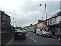
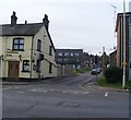
3
Apsley End: London Road
The boarded up windows on all the buildings in this block suggest that they are not long for this world, and that redevelopment is imminent. The road used to be the A41 but was downgraded to the A4251 when the A41 bypass was built.
Image: © Nigel Cox
Taken: 29 Jun 2008
0.04 miles
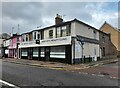
4
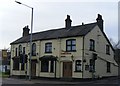
Apsley End: The White Lion public house
This Fuller's outlet is at the end of a Victorian terrace. The road in front is London Road, at one time the A41, now the A4251.
Image: © Nigel Cox
Taken: 29 Jun 2008
0.04 miles
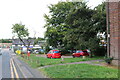
7
Frogmore Mill
This was the first mill in England to have a Fourdrinier paper machine (1803) and still uses a later version to produce recycled paper. It is now part of the Apsley Paper Trail and open on alternate Sundays in the season. Today was the first day of the season.
Image: © Chris Allen
Taken: 11 Mar 2007
0.06 miles
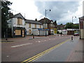
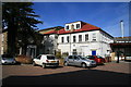
8
Junction of London Road / Weymouth Street
Image: © PAUL FARMER
Taken: 31 Jan 2009
0.06 miles
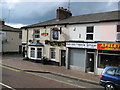
9
The Oddfellows Arms
Corner of London Road and Weymouth Street
Image: © PAUL FARMER
Taken: 31 Jan 2009
0.06 miles
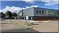
10
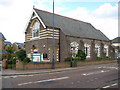
Apsley Community Centre
The Centre's ecclesiastical origins are obvious here. The 1926 Edition of the Ordnance Survey's mapping shows this building as a chapel. See http://www.hertsdirect.org/comdirectory/comvol/venue2y/vncomm3y/518714 for details of how to hire it.
Image: © Nigel Cox
Taken: 29 Jun 2008
0.06 miles