IMAGES TAKEN NEAR TO
Bunkers Lane, HEMEL HEMPSTEAD, HP3 8SP
Introduction
This page details the photographs taken nearby to Bunkers Lane, HP3 8SP by members of the Geograph project.
The Geograph project started in 2005 with the aim of publishing, organising and preserving representative images for every square kilometre of Great Britain, Ireland and the Isle of Man.

There are currently over 7.5m images from over14,400 individuals and you can help contribute to the project by visiting https://www.geograph.org.uk
Image Map
Images are licensed for reuse under creativecommons.org/licenses/by-sa/2.0
Notes
- Clicking on the map will re-center to the selected point.
- The higher the marker number, the further away the image location is from the centre of the postcode.
Image Listing (10 Images Found)
Images are licensed for reuse under creativecommons.org/licenses/by-sa/2.0
Image
Details
Distance
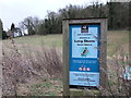
2
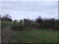
Kissing gate between Bunker's Lane and Park
Image: © PAUL FARMER
Taken: 31 Dec 2011
0.02 miles
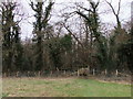
5

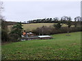
Hemel Hempstead: Bunker's Lane
Viewed looking south westwards down the valley with Bunker's Lane on the right.
Image: © Nigel Cox
Taken: 25 Feb 2006
0.05 miles
6
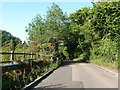
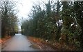
Bunkers Lane
The crash barrier is because there is a steep-sided dry valley on the left.
Image: © Robin Webster
Taken: 6 Sep 2015
0.06 miles
7
Embankment carrying Bunker's Lane through Bunker's Park
Image: © PAUL FARMER
Taken: 31 Dec 2011
0.12 miles
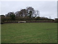
8
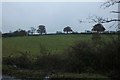
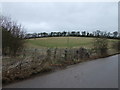
Fields by Bunkers Lane, Hemel Hempstead
Image: © David Howard
Taken: 25 Nov 2019
0.15 miles