IMAGES TAKEN NEAR TO
Crossfell Road, HEMEL HEMPSTEAD, HP3 8RQ
Introduction
This page details the photographs taken nearby to Crossfell Road, HP3 8RQ by members of the Geograph project.
The Geograph project started in 2005 with the aim of publishing, organising and preserving representative images for every square kilometre of Great Britain, Ireland and the Isle of Man.

There are currently over 7.5m images from over14,400 individuals and you can help contribute to the project by visiting https://www.geograph.org.uk
Image Map
Images are licensed for reuse under creativecommons.org/licenses/by-sa/2.0
Notes
- Clicking on the map will re-center to the selected point.
- The higher the marker number, the further away the image location is from the centre of the postcode.
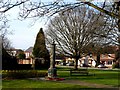
Image Listing (10 Images Found)
Images are licensed for reuse under creativecommons.org/licenses/by-sa/2.0
Image
Details
Distance
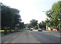
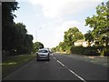
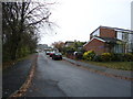
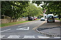
4
Leverstock Green Way
The direct route from Hemel Hempstead to St Albans
Image: © David Howard
Taken: 14 Nov 2014
0.17 miles
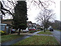
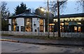
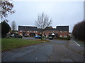
8
Flats on Poynders Hill, Leverstock Green
Image: © David Howard
Taken: 14 Nov 2014
0.23 miles
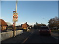
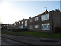
10
Church Road, Leverstock Green
Holy Trinity Church is on the left.
Image: © David Howard
Taken: 4 Sep 2022
0.24 miles