IMAGES TAKEN NEAR TO
Fieldfare Close, HEMEL HEMPSTEAD, HP3 0FJ
Introduction
This page details the photographs taken nearby to Fieldfare Close, HP3 0FJ by members of the Geograph project.
The Geograph project started in 2005 with the aim of publishing, organising and preserving representative images for every square kilometre of Great Britain, Ireland and the Isle of Man.

There are currently over 7.5m images from over14,400 individuals and you can help contribute to the project by visiting https://www.geograph.org.uk
Image Map
Images are licensed for reuse under creativecommons.org/licenses/by-sa/2.0
Notes
- Clicking on the map will re-center to the selected point.
- The higher the marker number, the further away the image location is from the centre of the postcode.
Image Listing (13 Images Found)
Images are licensed for reuse under creativecommons.org/licenses/by-sa/2.0
Image
Details
Distance
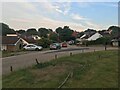

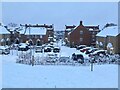
3

Shendish Manor golf course (in the snow), Apsley
Image: © Bryn Holmes
Taken: 16 Dec 2022
0.11 miles
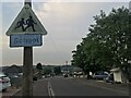
9

NEW
Green on Shendish Manor Golf Course
Image: © Philip Jeffrey
Taken: 9 Mar 2025
0.22 miles
10
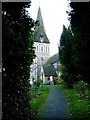
Apsley End - St Mary's Church
Church of St Mary, near London Road, Hemel Hempstead, Hertfordshire. Listed Grade II. Built in 1871 by Joseph Clarke.
Image: © Oxfordian Kissuth
Taken: Unknown
0.23 miles