IMAGES TAKEN NEAR TO
Rowan Close, HEMEL HEMPSTEAD, HP2 4FP
Introduction
This page details the photographs taken nearby to Rowan Close, HP2 4FP by members of the Geograph project.
The Geograph project started in 2005 with the aim of publishing, organising and preserving representative images for every square kilometre of Great Britain, Ireland and the Isle of Man.

There are currently over 7.5m images from over14,400 individuals and you can help contribute to the project by visiting https://www.geograph.org.uk
Image Map
Images are licensed for reuse under creativecommons.org/licenses/by-sa/2.0
Notes
- Clicking on the map will re-center to the selected point.
- The higher the marker number, the further away the image location is from the centre of the postcode.
Image Listing (17 Images Found)
Images are licensed for reuse under creativecommons.org/licenses/by-sa/2.0
Image
Details
Distance
2
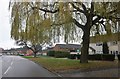
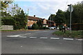
Windmill Road at the junction of White Hart Road
Image: © David Howard
Taken: 23 Nov 2019
0.13 miles
3
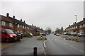
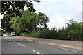
Windmill Road at the junction of White Hart Road
Image: © David Howard
Taken: 23 Nov 2019
0.14 miles
6
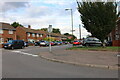
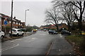
Windmill Road at the corner of Lower Yott
Image: © David Howard
Taken: 4 Sep 2022
0.21 miles
9
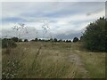
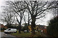
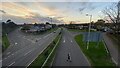
Wasteland, Jarman Park
This land was originally earmarked for a hotel to be constructed on it back in 1994, but nothing ever came of it. It has since stood wasting away, uncared for and abandoned. Multiple plans for development on the site have come and gone over the years. Most recently, Lidl has applied to construct a store on it.
Image: © Bryn Holmes
Taken: 30 Aug 2014
0.22 miles