1
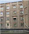
Silos, Heygate's Tring Mill
Part of a large flour mill by the Wendover Arm of the Grand Union Canal.
Image: © Robin Webster
Taken: 25 May 2014
0.03 miles
2
The mill at New Mill
A large frieze was saved from the original mill, but now it lies on the ground beside the present entrance to the mill, forlorn and vandalised. However, at least this two-foot high wheatsheaf fragment was sufficiently intact to enable a photo to be taken.
Image: © David Sands
Taken: 10 Jul 2009
0.04 miles
3
Tringford Road, Tring
Image: © David Howard
Taken: 11 Feb 2018
0.05 miles
4
The New Mill, Tring, from Bulbourne Road
New Mill is a flour mill - and until about 100 years ago there was a windmill on the site.
Image: © Chris Reynolds
Taken: 12 Dec 2012
0.05 miles
5
The mill at New Mill
Line-up of lorries in the yard at New Mill flourmill
Image: © David Sands
Taken: 10 Jul 2009
0.05 miles
6
Tringford Road, New Mill
New Mill's direct service to Luton Airport negotiates Tringford Road
Image: © David Sands
Taken: 3 Jul 2009
0.05 miles
7
Grass surface towpath on Wendover Arm, Grand Union Canal
From Bulbourne to the flour mill at Tring Wharf the towpath has a hard surface. Just past the mill it changes to a grass surface for most of the stretch to the present end of the canal.
Image: © David Hawgood
Taken: 3 Sep 2014
0.05 miles
8
Grand Union Canal (Wendover Arm): Tring Mill
The mill is currently owned by Heygates, and their website, with a history of the mill, is here http://www.heygates.co.uk/general/the-mills/ The enormous mill buildings are totally at odds with the very rural nature of the rest of the canal arm.
Image: © Nigel Cox
Taken: 12 Sep 2013
0.05 miles
9
Heygates Flour Mill
Much photographed already, but I quite like the tree shadows on this one.
A large modern mill where a windmill once stood, this is one of three mills operated by Heygates.
History of all three, plus recipes and lots of stuff about flour on their site http://www.heygates.co.uk/general/the-mills/
Image: © Des Blenkinsopp
Taken: 9 Oct 2015
0.05 miles
10
Wendover Arm at Gamnel Wharf
There has been flour milling at Gamnel Wharf since the 19th century - and possibly before - the last windmill, run by William Mead, being demolished in 1910 to make way for a wheat storage silo. In those days, Mead lived on site, in a house next to the yard, and owned much of the area taken by the mill of today. The remaining space was occupied by boat-builders, Bushell Brothers, who built narrowboats. The business was taken over by Heygates in 1944, since when it has undergone a series of remodellings and now has a milling capacity of over 10 tonnes of wheat per hour. Its fleet of articulated trucks deliver flour throughout the South of England.
While the Mill is not a pretty sight, it is a significant employer in Tring.
Image: © Gerald Massey
Taken: 13 Sep 2009
0.06 miles


