IMAGES TAKEN NEAR TO
Hale Lane, AYLESBURY, HP22 6QP

Introduction

This page details the photographs taken nearby to Hale Lane, HP22 6QP by members of the Geograph project.

The Geograph project started in 2005 with the aim of publishing, organising and preserving representative images for every square kilometre of Great Britain, Ireland and the Isle of Man.

There are currently over 7.5m images from over14,400 individuals and you can help contribute to the project by visiting https://www.geograph.org.uk

Image Map


Images are licensed for reuse under creativecommons.org/licenses/by-sa/2.0
Notes
  • Clicking on the map will re-center to the selected point.
  • The higher the marker number, the further away the image location is from the centre of the postcode.

Image Listing (7 Images Found)

Images are licensed for reuse under creativecommons.org/licenses/by-sa/2.0
Image
Details
Distance
1
Forestry Cottages on Hale Lane
Image: © David Howard Taken: 14 Apr 2018
0.02 miles
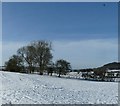
2
Field boundary at The Hale
The Hale is a small group of houses in the countryside to the east of Wendover. These trees and hedge mark a field boundary. See also Image]
Image: © Rob Farrow Taken: 26 Jan 2013
0.14 miles
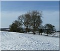
3
Clump of trees at The Hale
A closer view of the trees seen in Image The dark limbs of the trees contrast with bright snow.
Image: © Rob Farrow Taken: 26 Jan 2013
0.14 miles
4
Houses in The Hale
Image: © David Howard Taken: 14 Apr 2018
0.15 miles
5
100 Years of Forestry
The sign on the stone says "This avenue was planted to celebrate 100 years of forestry 1919 - 2019"
Image: © Des Blenkinsopp Taken: 12 Jul 2022
0.17 miles
6
A house at The Hale
The Hale has very few buildings, this one is on the loop of road as it goes southwards. Opposite are fields currently dotted with lambs.
Image: © Rob Farrow Taken: 29 Apr 2006
0.17 miles
7
View from The Hale
The view back towards Wendover from The Hale. The hills in the background are Wendover Woods.
Image: © Rob Farrow Taken: 29 Apr 2006
0.17 miles