IMAGES TAKEN NEAR TO
College Road, AYLESBURY, HP22 5EW

Introduction

This page details the photographs taken nearby to College Road, HP22 5EW by members of the Geograph project.

The Geograph project started in 2005 with the aim of publishing, organising and preserving representative images for every square kilometre of Great Britain, Ireland and the Isle of Man.

There are currently over 7.5m images from over14,400 individuals and you can help contribute to the project by visiting https://www.geograph.org.uk

Image Map


Images are licensed for reuse under creativecommons.org/licenses/by-sa/2.0
Notes
  • Clicking on the map will re-center to the selected point.
  • The higher the marker number, the further away the image location is from the centre of the postcode.

Image Listing (15 Images Found)

Images are licensed for reuse under creativecommons.org/licenses/by-sa/2.0
Image
Details
Distance
1
Klargester HQ
Klargester are makers of a large range of sewage treatment plants and equipment, and this is their headquarters tucked behind a row of trees off College Lane out of Aston Clinton. Interestingly the industrial units of College Lane can no longer be accessed via the village of Aston Clinton but only from the new A41 bypass - though any lorries still have to negotiate a narrow hump-back canal bridge at SP87111397 (see Image]). [Edit March 09] Since taking this photo, Klargester seems have become part of the Kingspan Environmental Group - their website can be visited here http://www.kingspanenv.com/Default.aspx
Image: © Rob Farrow Taken: 6 Nov 2007
0.03 miles
2
Klargester Factory, College Road North
At the bottom of a country lane – miles from anywhere – and one finds a large industrial site. Klargaster http://www.klargester.com/ manufacturer equipment used for pollution control, etc.
Image: © Chris Reynolds Taken: 23 Apr 2009
0.04 miles
3
Looking South along College Road N
College Road North ends in a dirt track after passing through a large industrial site.
Image: © Chris Reynolds Taken: 23 Apr 2009
0.06 miles
4
Bridleway going East from End of College Road N
This Bridleway runs towards Puttenham. It has clearly has been “improved” to a high standard in the not too distant past.
Image: © Chris Reynolds Taken: 23 Apr 2009
0.09 miles
5
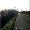
College Lane North - View South
College Lane North has various industrial units most notably the Image] - this is the view southwards looking away from the buildings towards the canal and A41 (neither of which can be seen in this image).
Image: © Rob Farrow Taken: 6 Nov 2007
0.10 miles
6
Bridleway to Puttenham
By College business park the bridleway to Puttenham
Image: © Shaun Ferguson Taken: 25 Feb 2011
0.10 miles
7
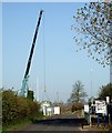
Tall Crane, College Lane, Aston Clinton
I'm not sure whether this tall crane was raising or lowering the green object suspended beneath it. I presume it has something to do with Image] which is off to the right of this image.
Image: © Rob Farrow Taken: 6 Nov 2007
0.11 miles
8
Farmland near Aston Clinton
Farmland to the north of the Grand Union Canal near Aston Clinton.
Image: © Philip Halling Taken: 18 Mar 2024
0.14 miles
9
Sidespill Weir at Merrymead Farm Winding Hole on the Aylesbury Arm Canal
On the north side of the winding hole there is a sidespill weir that takes off excess water from the Aylesbury Arm Image into the Draytonmead Brook which can be seen heading off in a north west direction. When this photo was taken a significant amount of water was flowing over the lock gate at Red House Lock (No 13) and this stretch of the canal was brimful and water was flowing over the weir. It should be noted that in addition to flow through the Aylesbury Arm Top Lock, water enters the canal through two streams, the Gudgeon Brook and the Draytonmead Brook. To the West: Image To the East Image
Image: © Chris Reynolds Taken: 30 Mar 2009
0.21 miles
10
Merrymead Farm from College Road North
From a distance I could not determine whether any of the buildings are used for agricultural purposes.
Image: © Chris Reynolds Taken: 23 Apr 2009
0.23 miles