1
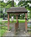
Carlsberg for The Chequers
A delivery for this smart pub/restaurant along Church Lane.
Image: © Des Blenkinsopp
Taken: 13 Sep 2016
0.03 miles
2
Gable End of Thatched Cottage in School Lane
26 School Lane dates back to the 17th century and is a timber framed building with painted plaster and brick infill. It was originally two cottages.
Image: © Chris Reynolds
Taken: 16 Apr 2009
0.08 miles
3
Thatched Cottage in School Lane, Weston Turville
26 School Lane dates back to the 17th century and is a timber framed building with painted plaster and brick infill. It was originally two cottages.
Image: © Chris Reynolds
Taken: 16 Apr 2009
0.09 miles
4
Weston Turville - The brook
A view upstream along the brook which has flowed roughly northwards from Weston Turville reservoir. It is seen here as it is about to flow under Church Lane on the eastern outskirts of the village.
Image: © Rob Farrow
Taken: 31 May 2014
0.22 miles
5
Main Street, Weston Turville
Image: © David Howard
Taken: 19 May 2015
0.22 miles
6
Weston Turville: Middle Field
The community shops and Post Office in Weston Turville, in Middle Field next to the B4544 Main Street.
Image: © Nigel Cox
Taken: 8 Apr 2006
0.23 miles
7
Main Street, Weston Turville
Image: © David Howard
Taken: 10 Oct 2021
0.23 miles
8
Weston Turville - St.Mary's - Porch
St.Mary's in Weston Turville has a charming little half timbered porch containing a venerable wooden door. The porch is on the church's northern side. The church contains a fine example of a C12th "Aylesbury" font (see shared description below).
Image: © Rob Farrow
Taken: 31 May 2014
0.23 miles
9
Weston Turville - St.Mary's - "Tapsell" lychgate
This unusual lychgate is at the entrance to the grounds of St Mary's church in Weston Turville. It is of the "Tapsell" type which has a double width gate pivoted about a central pillar, and in this case counterbalanced by a weight to ease its operation. There is a small plaque on the gate stating that:
"This Tapsell Lychgate was faithfully renovated by Don Billing 2004"
Image: © Rob Farrow
Taken: 31 May 2014
0.23 miles
10
Weston Turville - St.Mary's - Northern fa?ade
The northern façade of St.Mary's church in Weston Turville. The church is EH Grade I listed http://list.english-heritage.org.uk/resultsingle.aspx?uid=1118358&searchtype=mapsearch
The church contains a fine example of a C12th "Aylesbury" font (see shared description below).
Image: © Rob Farrow
Taken: 31 May 2014
0.24 miles


