IMAGES TAKEN NEAR TO
Swan Close, AYLESBURY, HP22 4LF
Introduction
This page details the photographs taken nearby to Swan Close, HP22 4LF by members of the Geograph project.
The Geograph project started in 2005 with the aim of publishing, organising and preserving representative images for every square kilometre of Great Britain, Ireland and the Isle of Man.

There are currently over 7.5m images from over14,400 individuals and you can help contribute to the project by visiting https://www.geograph.org.uk
Image Map (Loading...)


Getting Data...Please wait
Leaflet Map data © OpenStreetMap
Images are licensed for reuse under creativecommons.org/licenses/by-sa/2.0
Notes
- Clicking on the map will re-center to the selected point.
- The higher the marker number, the further away the image location is from the centre of the postcode.
Image Listing (21 Images Found)
Images are licensed for reuse under creativecommons.org/licenses/by-sa/2.0
Image
Details
Distance
5
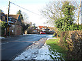
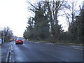
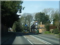
View towards A413 junction
Picture taken from Cublington road
Image: © John Firth
Taken: 25 Dec 2009
0.05 miles
7
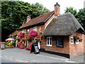
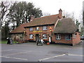
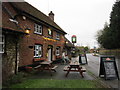
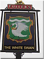
The White Swan
The building is early C19. See http://www.britishlistedbuildings.co.uk/en-42357-the-white-swan-whitchurch-buckinghamshire
Image: © Bikeboy
Taken: 21 Aug 2014
0.06 miles
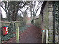
9
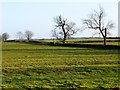
Pasture, Whitchurch
Fields on the eastern edge of the village. Like many in the area, they show the remains of mediaeval ridge and furrow.
Image: © Andrew Smith
Taken: 24 Jan 2015
0.09 miles