IMAGES TAKEN NEAR TO
Blackgrove Road, AYLESBURY, HP22 4AH
Introduction
This page details the photographs taken nearby to Blackgrove Road, HP22 4AH by members of the Geograph project.
The Geograph project started in 2005 with the aim of publishing, organising and preserving representative images for every square kilometre of Great Britain, Ireland and the Isle of Man.

There are currently over 7.5m images from over14,400 individuals and you can help contribute to the project by visiting https://www.geograph.org.uk
Image Map
Images are licensed for reuse under creativecommons.org/licenses/by-sa/2.0
Notes
- Clicking on the map will re-center to the selected point.
- The higher the marker number, the further away the image location is from the centre of the postcode.
Image Listing (14 Images Found)
Images are licensed for reuse under creativecommons.org/licenses/by-sa/2.0
Image
Details
Distance
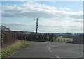
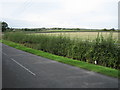
1
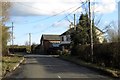
The Willows near Quainton
The Willows runs towards Aylesbury.
Image: © Steve Daniels
Taken: 3 Mar 2015
0.01 miles
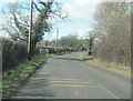
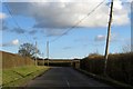
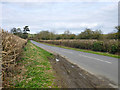
3
Bridleway to Lower Denham Farm
By The Willows the bridleway to Lower Denham Farm
Image: © Shaun Ferguson
Taken: 4 Nov 2009
0.06 miles
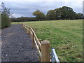
4
Farm track on to pasture by The Strand
Image: © Philip Jeffrey
Taken: 27 Jul 2013
0.14 miles
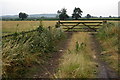
7
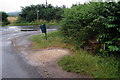
Mounting steps by the junction with The Strand
Image: © Philip Jeffrey
Taken: 27 Jul 2013
0.15 miles
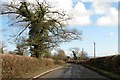
10
Lane to Denham
This is only signposted to Denham, but it is as good a way as any to the upper, older part of Quainton.
Image: © Robin Webster
Taken: 27 Mar 2015
0.21 miles