IMAGES TAKEN NEAR TO
Jasmine Close, AYLESBURY, HP21 9SH
Introduction
This page details the photographs taken nearby to Jasmine Close, HP21 9SH by members of the Geograph project.
The Geograph project started in 2005 with the aim of publishing, organising and preserving representative images for every square kilometre of Great Britain, Ireland and the Isle of Man.

There are currently over 7.5m images from over14,400 individuals and you can help contribute to the project by visiting https://www.geograph.org.uk
Image Map (Loading...)


Getting Data...Please wait
Leaflet Map data © OpenStreetMap
Images are licensed for reuse under creativecommons.org/licenses/by-sa/2.0
Notes
- Clicking on the map will re-center to the selected point.
- The higher the marker number, the further away the image location is from the centre of the postcode.
Image Listing (9 Images Found)
Images are licensed for reuse under creativecommons.org/licenses/by-sa/2.0
Image
Details
Distance
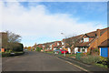
1
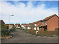
Nash Close, Aylesbury
A small part of Aylesbury's extensive ring of suburbs.
Image: © Des Blenkinsopp
Taken: 18 Nov 2016
0.16 miles
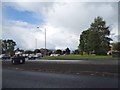
5
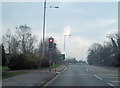
A413 approaching Bedgrove Roundabout
Travelling south
Image: © John Firth
Taken: 17 Mar 2012
0.24 miles
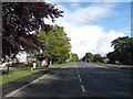
6
Wendover Road out of Aylesbury
The A413 runs from Aylesbury to Wendover.
Image: © Steve Daniels
Taken: 13 Feb 2014
0.25 miles
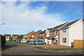
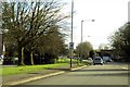
7
Wendover Road at the junction of Camborne Road
Image: © David Howard
Taken: 19 May 2015
0.25 miles