1
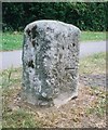
Benchmark on #21 Whaddon Chase
Ordnance Survey cut mark benchmark described on the Bench Mark Database at http://www.bench-marks.org.uk/bm35809
Image: © Roger Templeman
Taken: 25 Oct 2010
0.02 miles
2
Buckingham Road, Aylesbury, Bucks
A mainly residential road but also an important through route in the town.
Image: © P L Chadwick
Taken: 27 Oct 2014
0.07 miles
3
Looking north along Buckingham Road towards junction with Weedon Road
The stone on the foreground is a milestone
Image: © Roger Templeman
Taken: 25 Oct 2010
0.08 miles
4
The New Zealand on Buckingham Road
Image: © John Firth
Taken: 20 Mar 2012
0.08 miles
5
Benchmark on old milestone on Buckingham Road
Ordnance Survey cut mark benchmark described on the Bench Mark Database at http://www.bench-marks.org.uk/bm30729
Image: © Roger Templeman
Taken: 25 Oct 2010
0.08 miles
6
The New Zealand (1), 175 Buckingham Road, Aylesbury, Bucks
A local pub in what used to be a hamlet called New Zealand but is now part of Aylesbury.
Image
Image: © P L Chadwick
Taken: 27 Oct 2014
0.08 miles
7
The New Zealand (2) - sign, 175 Buckingham Road, Aylesbury, Bucks
The sign shows a picture of the famous Captain James Cook (1728-1779), who made the first recorded circumnavigation of New Zealand. The picture seems to be closely based on the painting of Captain Cook by Nathaniel Dance-Holland of about 1775, which is at the National Maritime Museum in Greenwich London. Although Captain Cook has no known direct link with Aylesbury, the pub is in what was a hamlet of that name, now part of Aylesbury, and was apparently named after a breed of cow of that name.
Image
Image: © P L Chadwick
Taken: 27 Oct 2014
0.08 miles
8
Old Milestone by the A413 in Aylesbury
Carved stone post by the A413, in parish of Aylesbury (Aylesbury Vale District), Buckingham Road; by No. 215, in Manor Park, South of by-pass roundabout, on wide well cut grass verge; between footpath and drive, on East side of road. Aylesbury square, erected by the Wendover & Buckingham turnpike trust in the 18th century.
Inscription once read:-
: (Buckingham / 16) : : (Aylesbury / 1) :
Carved benchmark lower front.
Buckinghamshire HER.
HER Number: 1358400000 https://www.heritagegateway.org.uk/Gateway/Results_Single.aspx?uid=MBC25738&resourceID=1024
Milestone Society National ID: BU_LC40
Image: © A Rosevear & J Higgins
Taken: 19 Jul 2003
0.09 miles
9
Benchmark on #69 Whaddon Chase
Ordnance survey cut mark benchmark described on the Bench Mark Database at http://www.bench-marks.org.uk/bm35810
Image: © Roger Templeman
Taken: 25 Oct 2010
0.10 miles
10
Whaddon Chase Allotments, Aylesbury
Accessed from Selkirk Avenue, not Whaddon Chase.
Image: © Robin Webster
Taken: 28 Dec 2017
0.12 miles


