IMAGES TAKEN NEAR TO
Ludgershall Road, AYLESBURY, HP18 9TY
Introduction
This page details the photographs taken nearby to Ludgershall Road, HP18 9TY by members of the Geograph project.
The Geograph project started in 2005 with the aim of publishing, organising and preserving representative images for every square kilometre of Great Britain, Ireland and the Isle of Man.

There are currently over 7.5m images from over14,400 individuals and you can help contribute to the project by visiting https://www.geograph.org.uk
Image Map
Images are licensed for reuse under creativecommons.org/licenses/by-sa/2.0
Notes
- Clicking on the map will re-center to the selected point.
- The higher the marker number, the further away the image location is from the centre of the postcode.
Image Listing (6 Images Found)
Images are licensed for reuse under creativecommons.org/licenses/by-sa/2.0
Image
Details
Distance
1
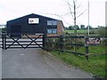
Tramway Business Park
The business park gets its name from the Brill Tramway, which ran from Quainton Road and terminated in a station near where the business park stands today. It is astonishing to think that this was the terminus of a branch of the Metropolitan Line, run by the London Underground until 1936.
Image: © Hywel Williams
Taken: 15 Mar 2005
0.06 miles
2
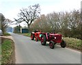
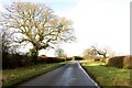
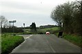
Vintage tractors down the lane
There was a bit of a tractor fest going on along here today as I was driving past.
There were a whole lot more a bit further down where those people are standing in the haze of blue smoke.
Image: © Des Blenkinsopp
Taken: 21 Mar 2015
0.06 miles
3
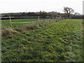
Bernwood Jubilee Way
Bernwood Jubilee Way heading to Tram Hill
Image: © Shaun Ferguson
Taken: 31 Oct 2009
0.18 miles