IMAGES TAKEN NEAR TO
Crendon Road, AYLESBURY, HP18 9HA
Introduction
This page details the photographs taken nearby to Crendon Road, HP18 9HA by members of the Geograph project.
The Geograph project started in 2005 with the aim of publishing, organising and preserving representative images for every square kilometre of Great Britain, Ireland and the Isle of Man.

There are currently over 7.5m images from over14,400 individuals and you can help contribute to the project by visiting https://www.geograph.org.uk
Image Map
Images are licensed for reuse under creativecommons.org/licenses/by-sa/2.0
Notes
- Clicking on the map will re-center to the selected point.
- The higher the marker number, the further away the image location is from the centre of the postcode.
Image Listing (5 Images Found)
Images are licensed for reuse under creativecommons.org/licenses/by-sa/2.0
Image
Details
Distance
1
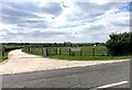
New Village Farm
This is quite recent, and doesn't appear on older OS maps.
Image: © Des Blenkinsopp
Taken: 14 Jul 2014
0.01 miles
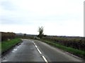
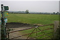
3
Crendon Road
From Shabbington towards Long Crendon.
Image: © Robin Webster
Taken: 22 Mar 2020
0.10 miles
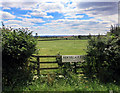
4
Bernwood Way heading to Shabbington
Bernwood Way/Thame Valley Walk heading to Shabbington
Image: © Shaun Ferguson
Taken: 25 Oct 2007
0.11 miles