IMAGES TAKEN NEAR TO
Grendon Underwood, AYLESBURY, HP18 0SX
Introduction
This page details the photographs taken nearby to HP18 0SX by members of the Geograph project.
The Geograph project started in 2005 with the aim of publishing, organising and preserving representative images for every square kilometre of Great Britain, Ireland and the Isle of Man.

There are currently over 7.5m images from over14,400 individuals and you can help contribute to the project by visiting https://www.geograph.org.uk
Image Map (6 Images)


Getting Data...Please wait
Leaflet Map data © OpenStreetMap
Images are licensed for reuse under creativecommons.org/licenses/by-sa/2.0
Notes
- Clicking on the map will re-center to the selected point.
- The higher the marker number, the further away the image location is from the centre of the postcode.
Image Listing (6 Images Found)
Images are licensed for reuse under creativecommons.org/licenses/by-sa/2.0
Image
Details
Distance

2
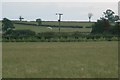
quartering barn owl
A real treat to watch, working its way up and down, dropping on something, then carrying on.
Image: © David Luther Thomas
Taken: 16 Jun 2007
0.12 miles
5
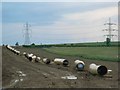
Pipes and pylons!
What every rambler dreams of seeing!
The beasts after the beauty of Image
The contrasts that can be found in gridsquares.
Image: © David Luther Thomas
Taken: 16 Jun 2007
0.21 miles
6
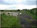
Gallowsbridge Farm
Presumably once the site of?
Image: © David Luther Thomas
Taken: 16 Jun 2007
0.25 miles