IMAGES TAKEN NEAR TO
Upper Winchendon, AYLESBURY, HP18 0EG
Introduction
This page details the photographs taken nearby to HP18 0EG by members of the Geograph project.
The Geograph project started in 2005 with the aim of publishing, organising and preserving representative images for every square kilometre of Great Britain, Ireland and the Isle of Man.

There are currently over 7.5m images from over14,400 individuals and you can help contribute to the project by visiting https://www.geograph.org.uk
Image Map
Images are licensed for reuse under creativecommons.org/licenses/by-sa/2.0
Notes
- Clicking on the map will re-center to the selected point.
- The higher the marker number, the further away the image location is from the centre of the postcode.
Image Listing (5 Images Found)
Images are licensed for reuse under creativecommons.org/licenses/by-sa/2.0
Image
Details
Distance
2
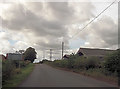
Footpath by The Limes
Footpath by The Limes heading down to the River Thame
Image: © Shaun Ferguson
Taken: 4 Nov 2009
0.12 miles
3
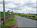
Upper Winchendon: Main Road
The road between Upper Winchendon and Chearsley looking towards the former.
Image: © Nigel Cox
Taken: 7 Jun 2006
0.17 miles
4
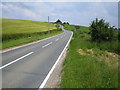
Road towards Upper Winchendon
Upper Winchendon on the hill, Lower Winchendon down in the valley to the right.
Image: © Robin Webster
Taken: 27 Mar 2015
0.18 miles
5
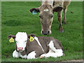
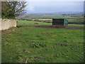
Cattle, Upper Winchendon
Beside the drive to Decoy Farm.
Image: © Andrew Smith
Taken: 26 Apr 2007
0.23 miles