1
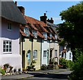
Aylesbury Road, Chearsley
Image: © David Howard
Taken: 10 Oct 2021
0.07 miles
2
Unusual tree, Chearsley
At the corner of Winchendon Road. The war memorial is visible in the background (to the right of the tree).
Image: © Bikeboy
Taken: 1 Nov 2014
0.08 miles
3
Crossroads at Chearsley
Image: © Des Blenkinsopp
Taken: 6 Apr 2015
0.09 miles
4
The Old Vicarage, Chearsley
Built around 1870. The architect was George Devey (1820-86) who is chiefly known for his work for the Rothschilds. See http://www.britishlistedbuildings.co.uk/en-42960-the-vicarage-chearsley-buckinghamshire for entry in British Listed Buildings
Image: © Bikeboy
Taken: 1 Nov 2014
0.10 miles
5
Chearsley from Winchendon road
Image: © John Firth
Taken: 25 Sep 2012
0.10 miles
6
Old House, Chearsley, Buckinghamshire
C17 with C18 additions. Timber framed with brick infill on rubblestone plinth, 2 centre bays, then colourwashed and rendered east bay, and to west 2 bay rubblestone addition and 2 bay barn beyond, rubblestone lower part, colourwashed render upper part. Plain tile roofs. Timber frame bays have central door with gabled hood on brackets. Each bay has 3-light casements. C17 central stack of old thin bricks. East bay has 3-light ground floor casement. West bays have doorway at right, swept eaves breaking upper floor 3-light casement, two 2-light casements to ground floor with cambered brick arches. Left hand part has blocked barn door with casement over.
(Source:Historic England)
Image: © Oswald Bertram
Taken: 9 Jul 2015
0.11 miles
7
Houses by The Green, Chearsley
The large house is 18th century, grade II listed.
Image: © Robin Webster
Taken: 22 Mar 2020
0.11 miles
8
Red Pillar Box, Chearsley
This pillar box is located at the east end of The Green HP18 0DJ and has the GviR cipher inscribed on it which indicates that the box dates from the reign of King George VI (1936-1952). The white plate below the letters slot mentions that the final collection on Mondays to Fridays is 4.00pm, whilst on Saturdays it is 10.30am. To the left of the pillar box is a bus shelter with a notice that says 'BUS STOP Chearsley'.
Image: © David Hillas
Taken: 7 Apr 2022
0.12 miles
9
School Lane, Chearsley, Buckinghamshire
Image: © Oswald Bertram
Taken: 9 Jul 2015
0.13 miles
10
Chilton Road, Chearsley
Image: © David Howard
Taken: 10 Oct 2021
0.13 miles


