IMAGES TAKEN NEAR TO
Stratfords Way, AYLESBURY, HP17 8HT

Introduction

This page details the photographs taken nearby to Stratfords Way, HP17 8HT by members of the Geograph project.

The Geograph project started in 2005 with the aim of publishing, organising and preserving representative images for every square kilometre of Great Britain, Ireland and the Isle of Man.

There are currently over 7.5m images from over14,400 individuals and you can help contribute to the project by visiting https://www.geograph.org.uk

Image Map


Images are licensed for reuse under creativecommons.org/licenses/by-sa/2.0
Notes
  • Clicking on the map will re-center to the selected point.
  • The higher the marker number, the further away the image location is from the centre of the postcode.

Image Listing (18 Images Found)

Images are licensed for reuse under creativecommons.org/licenses/by-sa/2.0
Image
Details
Distance
1
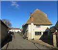
New Thatch in Haddenham
This is Haddenham High Street, very narrow and quiet compared to most.
Image: © Des Blenkinsopp Taken: 17 Feb 2015
0.06 miles
2
Bus at The House Of Spice
What looks to have been a large pub is now a large Indian Restaurant. Let's hope curry succeeds where beer failed.
Image: © Des Blenkinsopp Taken: 17 Feb 2015
0.07 miles
3
Haddenham village centre
High Street leads off to the right from Banks Road.
Image: © Steve Daniels Taken: 13 Feb 2014
0.08 miles
4
Quaker Burial Ground, Haddenham
Situated in Banks Parade HP17 8ED, this burial ground is the remains of a Friends Meeting House which was officially licensed in 1711 and stood here until the 19th century. The first burial took place in 1694 and there are a total of twenty three burials at this site. Inscribed in this burial ground is the verse from the Gospel of St John Ch 11 v 26 "Whosoever liveth and believeth in me shall never die". Nearby is Quakers Mede which comprises of nineteen detached houses and is a reminder of the Quakers who used to meet in Haddenham a long time ago.
Image: © David Hillas Taken: 6 May 2019
0.10 miles
5
Bend into High Street
The House of Spice restaurant is opposite round the bend.
Image: © Steve Daniels Taken: 13 Feb 2014
0.10 miles
6
Shops along Banks Road.
Image: © Des Blenkinsopp Taken: 17 Feb 2015
0.11 miles
7
Road junction seen from east side of Churchways
The road to the left is Banks Road, the one to the right Woodways.
Image: © Roger Templeman Taken: 13 Sep 2010
0.13 miles
8
Haddenham Methodist Church
Situated in High Street HP17 8ES, this Methodist church dates from 1822 and is said to be the tallest Witchert building in the world, Witchert being a mixture of white chalk and clay. It is one of seventeen churches in the Vale of Aylesbury Methodist Circuit. Services are held here each Sunday at 10.15am whilst activities take place during the week. To the left of the entrance door can be seen a notice that says "ALL VISITORS VERY WELCOME". Also, on a telegraph pole to the right of the photo is an arrow pointing towards that church across the road.
Image: © David Hillas Taken: 6 May 2019
0.14 miles
9
Mini-roundabout in Haddenham
This is the centre of the present built up area of Haddenham, but lies North of the original village centre
Image: © David Hawgood Taken: 25 Aug 2005
0.14 miles
10
Benchmark on #2 Crabtree Road
Ordnance Survey cut mark benchmark
Image: © Roger Templeman Taken: 13 Sep 2010
0.18 miles