IMAGES TAKEN NEAR TO
White Hart Lane, AYLESBURY, HP17 8BB
Introduction
This page details the photographs taken nearby to White Hart Lane, HP17 8BB by members of the Geograph project.
The Geograph project started in 2005 with the aim of publishing, organising and preserving representative images for every square kilometre of Great Britain, Ireland and the Isle of Man.

There are currently over 7.5m images from over14,400 individuals and you can help contribute to the project by visiting https://www.geograph.org.uk
Image Map
Images are licensed for reuse under creativecommons.org/licenses/by-sa/2.0
Notes
- Clicking on the map will re-center to the selected point.
- The higher the marker number, the further away the image location is from the centre of the postcode.
Image Listing (84 Images Found)
Images are licensed for reuse under creativecommons.org/licenses/by-sa/2.0
Image
Details
Distance
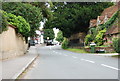
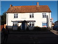
2
Skittles Green, Haddenham, Buckinghamshire
Image: © Oswald Bertram
Taken: 9 Jul 2015
0.08 miles
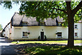
5
Morecraft House
Located at the beginning/end of Station Road.
Image: © Michael Trolove
Taken: 18 Nov 2012
0.11 miles
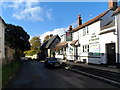
6
Cottages in Station Road, Haddenham
Cottages opposite the Rose and Thistle pub.
Image: © David Sands
Taken: 17 Aug 2007
0.11 miles
7
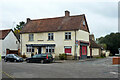
Morecraft House, Haddenham
A grade II listed building (as Moorcroft), 18th century. The unsigned shop on its right ought to be a butchers, it was reported that it reopened in June 2015, this view is October 2015. It closed again in 2019.
Image: © Robin Webster
Taken: 18 Oct 2015
0.11 miles
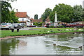
9

Station Road, Haddenham
Rendered walls are very common around Haddenham. The stile is similar to a Cob wall but is known locally as Wychert (other spellings are acceptable)
http://www.buildrightuk.com/WLWork.aspx
Image: © Michael Trolove
Taken: 18 Nov 2012
0.11 miles
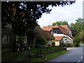
10
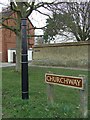
Direction Sign ? Signpost at Church End, Haddenham
Located in Church End, on the northeast side of the crossroads of Churchway, Station Road and Aston Road in Haddenham parish. No arms and lost finial. Dated before 1939.
Milestone Society National ID: BU_SP7408
Image: © John V Nicholls
Taken: 10 Oct 2009
0.12 miles