IMAGES TAKEN NEAR TO
Broomfield Hill, GREAT MISSENDEN, HP16 9PD
Introduction
This page details the photographs taken nearby to Broomfield Hill, HP16 9PD by members of the Geograph project.
The Geograph project started in 2005 with the aim of publishing, organising and preserving representative images for every square kilometre of Great Britain, Ireland and the Isle of Man.

There are currently over 7.5m images from over14,400 individuals and you can help contribute to the project by visiting https://www.geograph.org.uk
Image Map
Images are licensed for reuse under creativecommons.org/licenses/by-sa/2.0
Notes
- Clicking on the map will re-center to the selected point.
- The higher the marker number, the further away the image location is from the centre of the postcode.
Image Listing (10 Images Found)
Images are licensed for reuse under creativecommons.org/licenses/by-sa/2.0
Image
Details
Distance
1
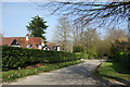
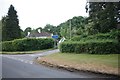
Broomfield Hill, Great Missenden
There is a hill, down into the Misbourne valley.
Image: © Des Blenkinsopp
Taken: 28 Mar 2022
0.03 miles
2
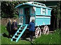
Roald Dahl's gipsy caravan
At Roald Dahl's house, Gipsy Cottage, in Great Missenden. Roald Dahl's gipsy caravan immortalized in "Danny the Champion of the World".
Image: © George Mahoney
Taken: 15 May 2002
0.07 miles
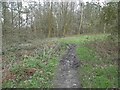
3
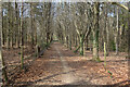
Bridleway through the trees
A wide woodland bridleway between Broomfield Hill and Broombarn Lane.
Image: © Des Blenkinsopp
Taken: 28 Mar 2022
0.14 miles
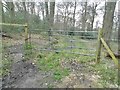
4
Shed in field by Broomfield Hill
Looking from the end of Upper Hollis.
Image: © Robin Webster
Taken: 9 Jun 2019
0.15 miles
5
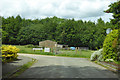
Field by Broombarn Lane, Great Missenden
Image: © David Howard
Taken: 14 Apr 2018
0.17 miles
6
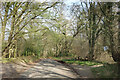
Broombarn Lane, Great Missenden
Heading downhill through Rignall Wood.
Image: © Des Blenkinsopp
Taken: 28 Mar 2022
0.18 miles
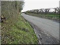
9
Rignall Road at the junction of Broombarn Lane
Image: © David Howard
Taken: 11 Jun 2020
0.23 miles
10
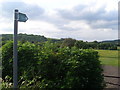
A Footpath Sign in Rignall Road
This photo shows a footpath sign in Rignall Road, indicating a footpath which goes under a railway bridge to Aylesbury Road, Mobwell. Coneybank Wood can be seen in the distance on the left of the photo.
Image: © David Hillas
Taken: 30 May 2012
0.25 miles