1
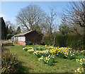
Farm access road To Andlows Farm, Prestwood, Bucks
It carries a footpath too.
Image: © Jeremy Bolwell
Taken: 14 Jan 2018
0.09 miles
2
Scout Group Headquarters, Prestwood
Situated in Nairdwood Lane HP16 0QF, this building is the meeting place for the First Prestwood Scout Group. To the right of the photo can just be seen the Prestwood Youth & Community Centre building.
Image: © David Hillas
Taken: 3 Jul 2017
0.10 miles
3
Sarsens by the Hedge
Sarsen is a type of hard sandstone that occurs in chalk areas. These blocks are by an entrance to Prestwood Recreation Ground.
Image: © Des Blenkinsopp
Taken: 5 Dec 2019
0.11 miles
4
High Street, Prestwood
Image: © David Howard
Taken: 4 Feb 2018
0.11 miles
5
Houses on High Street, Prestwood
Image: © David Howard
Taken: 4 Feb 2018
0.12 miles
6
Beacon on Prestwood Common
This photo shows a beacon that has been lit up on Prestwood Common to mark the 2022 Platinum Jubilee. It was one of several beacons being lit throughout the country to mark the Queen's 70 year reign. The metal beacon comprises of an old washing machine drum. Some spectators are looking on keeping at a safe distance. The Prestwood Community Centre can be seen in the background.
Image: © David Hillas
Taken: 3 Jun 2022
0.12 miles
7
Daffodils and a Shed
Spring flowers brighten up even the most ordinary scene.
This is by the footpath past Andlows Farm.
Image: © Des Blenkinsopp
Taken: 28 Mar 2022
0.12 miles
8
Former Prestwood Motors Petrol Station and Garage (2)
Taken in March 2002, this photo shows the former petrol station and garage at 12 High Street, Prestwood HP16 9EB. The car wash can be seen on the left of the photo whilst the petrol sign shows Unleaded petrol at 70.9 pence per litre, 4 star petrol at 76.9 pence per litre and diesel at 73.9 pence per litre. A far cry compared with today's fuel prices! Since the photo was taken, the garage has moved up the road to 86 High Street http://www.geograph.org.uk/photo/3899514 refers, but fuel is no longer sold there. Housing now occupies this site.
Image: © David Hillas
Taken: 4 Mar 2002
0.13 miles
9
Former Prestwood Motors Petrol Station and Garage (1)
Taken in March 2002, this photo shows the former petrol station and garage at 12 High Street, Prestwood HP16 9EB. It has since been closed and moved to 86 High Street http://www.geograph.org.uk/photo/3899505 refers. Housing now occupies this site.
Image: © David Hillas
Taken: 4 Mar 2002
0.14 miles
10
Tree with Remembrance labels, Prestwood (2)
Taken in Nairdwood Lane HP16 0NH near High Street, this tree has hand knitted poppies and thirty five labels on its branches. Each label has a name and photo of a person from Prestwood and the surrounding area who died during World War I (1914-1918). They were fixed to commemorate Remembrance Sunday 2018, exactly one hundred years after the end of World War I.
Image: © David Hillas
Taken: 12 Nov 2018
0.14 miles


