1
Name Plate at Peterley Sewage Pumping Station
This name plate in Peterley Lane HP16 0HH refers to the sewage pumping station behind it. It has been fixed to the gate by Thames Water, and mentions the emergency telephone number and the site reference PETEP2ZZ.
Image: © David Hillas
Taken: 7 Jun 2019
0.05 miles
2
Peterley Sewage Pumping Station, Prestwood
This sewage pumping station is located in Peterley Lane, HP16 0HH. It is managed by Thames Water.
Image: © David Hillas
Taken: 7 Jun 2019
0.06 miles
3
Bridleway in Peterley Wood
Image: © Des Blenkinsopp
Taken: 28 Mar 2022
0.07 miles
4
Graffiti on the Pump House
The back wall of Thames Water's Peterley sewage pumping station has been visited by graffiti artists.
Image: © Des Blenkinsopp
Taken: 28 Mar 2022
0.11 miles
5
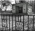
Peterley Sewage Pumping Station
A humble pumping station out in the woods, but dating from a time when even utility buildings had a bit of attention paid to their design.
This little pump house is out of the same stable as many a cinema or train station of the time.
Even the railings look more garden gate than sewage works.
Image: © Des Blenkinsopp
Taken: 28 Mar 2022
0.11 miles
6
Cafe in a yurt
The yurt is home to the Wild Strawberry Cafe at Peterley Manor Farm.
Image: © Mark Percy
Taken: 26 Jun 2020
0.14 miles
7
Peterley Manor Farm Shop
Image: © Mark Percy
Taken: 26 Jun 2020
0.15 miles
8
Peterley Manor Farm Shop, Prestwood
This farm shop is situated in Peterley Lane, Prestwood, HP16 0HH. Besides the farm shop, it also has a nursery, Christmas trees and Pick Your Own.
Image: © David Hillas
Taken: 22 Jun 2009
0.17 miles
9
Mr Hildreths Garden Centre in Prestwood
Image: © Steve Daniels
Taken: 6 Sep 2009
0.22 miles
10
War Memorial Plaque at Hildreths Garden Centre
This photo shows the war memorial plaque outside The Limes cafe at the Hildreths Garden Centre, 169 Wycombe Road, Prestwood, HP16 0HJ. The wording at the top says:
"In Memory of the Dutch, Canadian and British Airmen who died over and in Prestwood on the 26th August 1944".
In the middle of the plaque is a map of Prestwood where remains of the two Wellington aircraft that collided with each other are shown by fourteen crosses. Eleven names of the airmen who died are listed by the side of this map. Details of this air collision is mentioned in the Prestwood Archive a living history 1941 - 1960, http://prestwoodarchive.org.uk/1941to1960/2014/06/18/two-wellingtons-crash-over-prestwood/ refers.
At the bottom of the plaque is the wording "Dying for a noble cause is not the worst thing that could happen - being forgotten is".
Image: © David Hillas
Taken: 6 May 2019
0.25 miles


