IMAGES TAKEN NEAR TO
Deep Mill Lane, GREAT MISSENDEN, HP16 0DJ
Introduction
This page details the photographs taken nearby to Deep Mill Lane, HP16 0DJ by members of the Geograph project.
The Geograph project started in 2005 with the aim of publishing, organising and preserving representative images for every square kilometre of Great Britain, Ireland and the Isle of Man.

There are currently over 7.5m images from over14,400 individuals and you can help contribute to the project by visiting https://www.geograph.org.uk
Image Map
Images are licensed for reuse under creativecommons.org/licenses/by-sa/2.0
Notes
- Clicking on the map will re-center to the selected point.
- The higher the marker number, the further away the image location is from the centre of the postcode.
Image Listing (18 Images Found)
Images are licensed for reuse under creativecommons.org/licenses/by-sa/2.0
Image
Details
Distance
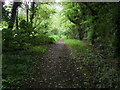
1
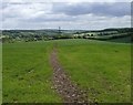
South Bucks Way across Little Boy's Heath
The South Bucks Way footpath crosses a huge field at Little Boy's Heath towards Little Missenden. This is also on the route of the London Green Belt Way.
Image: © Sean Davis
Taken: 20 May 2006
0.11 miles
2
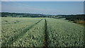
South Bucks Way
A 23 mile route following the valley of the River Misbourne
Image: © michael
Taken: 21 Jul 2013
0.11 miles
3
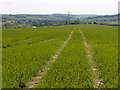
South Bucks Way
View towards Little Missenden.
Image: © Michael Trolove
Taken: 26 May 2013
0.12 miles
4
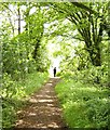
South Bucks Way towards Little Missenden
The South Bucks Way after leaving Little Kingshill on its way to cross Little Boy's Heath and on towards Little Missenden. This is also on the route of the London Green Belt Way.
Image: © Sean Davis
Taken: 20 May 2006
0.13 miles
5
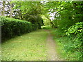
South Bucks Way
South Bucks Way off Windsor Lane
Image: © Shaun Ferguson
Taken: 30 May 2008
0.13 miles
8
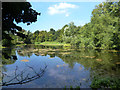
River Misbourne. Pond at Deep Mill
One of a series of ponds and lakes along this stretch of the Misbourne.
A lot of work has been put into improving the state of the Misbourne which for many years regularly used to dry up for most of its length.
Image: © Des Blenkinsopp
Taken: 4 Sep 2013
0.16 miles
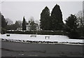
9
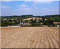
The Misbourne Valley
A view from the ploughed out South Bucks Way across the Misbourne valley to Deep Mill pumping station and beyond.
Image: © Des Blenkinsopp
Taken: 4 Sep 2013
0.18 miles
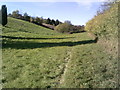
10
South Bucks Way from Little Kingshill
This path takes the South Bucks Way from Windsor Lane at Little Kingshill to Little Boys Heath and on towards Little Missenden. It is also on the route of the London Green Green Belt Way.
Image: © Sean Davis
Taken: 22 May 2009
0.19 miles