IMAGES TAKEN NEAR TO
Cricket Ground, HIGH WYCOMBE, HP14 3TY
Introduction
This page details the photographs taken nearby to Cricket Ground, HP14 3TY by members of the Geograph project.
The Geograph project started in 2005 with the aim of publishing, organising and preserving representative images for every square kilometre of Great Britain, Ireland and the Isle of Man.

There are currently over 7.5m images from over14,400 individuals and you can help contribute to the project by visiting https://www.geograph.org.uk
Image Map
Images are licensed for reuse under creativecommons.org/licenses/by-sa/2.0
Notes
- Clicking on the map will re-center to the selected point.
- The higher the marker number, the further away the image location is from the centre of the postcode.
Image Listing (72 Images Found)
Images are licensed for reuse under creativecommons.org/licenses/by-sa/2.0
Image
Details
Distance
1
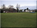
Cricket Ground Stokenchurch
Cricket Ground and pavilion Stokenchurch
Image: © Shaun Ferguson
Taken: 25 Feb 2008
0.05 miles
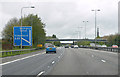
3
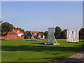
The cricket ground, Stokenchurch
Southwest of the village centre. The houses are just south of the A40.
Image: © Andrew Smith
Taken: 28 Sep 2008
0.07 miles
5
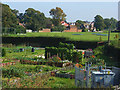
Allotments, Stokenchurch
A view across the allotments and the cricket ground towards the village centre.
Image: © Andrew Smith
Taken: 28 Sep 2008
0.08 miles
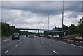
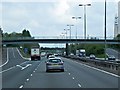
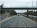
9
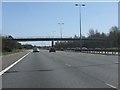
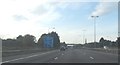
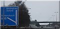
M40 motorway - footbridge east of junction 5
Image: © Peter Whatley
Taken: 1 Apr 2012
0.09 miles