IMAGES TAKEN NEAR TO
Guinions Road, HIGH WYCOMBE, HP13 7NX
Introduction
This page details the photographs taken nearby to Guinions Road, HP13 7NX by members of the Geograph project.
The Geograph project started in 2005 with the aim of publishing, organising and preserving representative images for every square kilometre of Great Britain, Ireland and the Isle of Man.

There are currently over 7.5m images from over14,400 individuals and you can help contribute to the project by visiting https://www.geograph.org.uk
Image Map
Images are licensed for reuse under creativecommons.org/licenses/by-sa/2.0
Notes
- Clicking on the map will re-center to the selected point.
- The higher the marker number, the further away the image location is from the centre of the postcode.
Image Listing (35 Images Found)
Images are licensed for reuse under creativecommons.org/licenses/by-sa/2.0
Image
Details
Distance
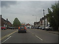
5
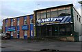
A40 Tyres on London Road, High Wycombe
Image: © David Howard
Taken: 27 Sep 2022
0.10 miles
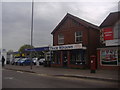
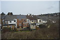
7
Tesco Express on London Road, High Wycombe
Image: © David Howard
Taken: 27 Sep 2022
0.12 miles
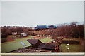
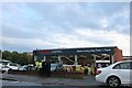
9
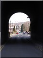
Micklefield Road, High Wycombe
A view northwards under the Chiltern Line railway.
Image: © Andrew Smith
Taken: 4 Apr 2006
0.12 miles
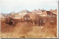
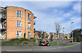
10
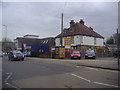
Burnham Garage and houses on London Road
Image: © David Howard
Taken: 13 Apr 2011
0.12 miles