IMAGES TAKEN NEAR TO
Hammersley Lane, HIGH WYCOMBE, HP13 7BX

Introduction

This page details the photographs taken nearby to Hammersley Lane, HP13 7BX by members of the Geograph project.

The Geograph project started in 2005 with the aim of publishing, organising and preserving representative images for every square kilometre of Great Britain, Ireland and the Isle of Man.

There are currently over 7.5m images from over14,400 individuals and you can help contribute to the project by visiting https://www.geograph.org.uk

Image Map


Images are licensed for reuse under creativecommons.org/licenses/by-sa/2.0
Notes
  • Clicking on the map will re-center to the selected point.
  • The higher the marker number, the further away the image location is from the centre of the postcode.

Image Listing (10 Images Found)

Images are licensed for reuse under creativecommons.org/licenses/by-sa/2.0
Image
Details
Distance
1
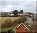
Hammersley Lane
Image: © N Chadwick Taken: 23 Dec 2012
0.06 miles
2
View from Hammersley Lane
Looking southwards. King's Mead is the expanse of grass in the valley. Fennell's Wood is on the hillside beyond.
Image: © Andrew Smith Taken: 6 Apr 2006
0.06 miles
3
Farmland above Loudwater
The extreme north of the grid-square.
Image: © Andrew Smith Taken: 6 Apr 2006
0.11 miles
4
Old Coach Drive, Wycombe Marsh
Image: © David Howard Taken: 26 Oct 2019
0.20 miles
5
Gomm Rd
Image: © N Chadwick Taken: 22 Feb 2015
0.22 miles
6
Shell petrol station on London Road, Wycombe Marsh
Image: © David Howard Taken: 17 Feb 2022
0.23 miles
7
Railway bridge over Gomm Road
Gomm Road is a minor road leading to and industrial complex, and as such, seems to be used mainly for vehicle parking. The railway was built in the early 1900's as the Great Western/Great Central Joint Line from Ashendon Junction to Northolt as an alternative route for Great Central trains to reach London Marylebone Station and a shorter route to Birmingham for the Great Western Railway.
Image: © Bob Walters Taken: 19 Aug 2022
0.23 miles
8
Shell petrol station on London Road, Wycombe Marsh
Image: © David Howard Taken: 12 Jan 2020
0.25 miles
9
Wycombe Heights Golf Centre
The southern end of the golf course. The mobile home park is to the right.
Image: © Andrew Smith Taken: 6 Apr 2006
0.25 miles
10
Wycombe Heights Golf Centre
Looking northeast across the golf course.
Image: © Andrew Smith Taken: 6 Apr 2006
0.25 miles