IMAGES TAKEN NEAR TO
Walton Drive, HIGH WYCOMBE, HP13 6UA
Introduction
This page details the photographs taken nearby to Walton Drive, HP13 6UA by members of the Geograph project.
The Geograph project started in 2005 with the aim of publishing, organising and preserving representative images for every square kilometre of Great Britain, Ireland and the Isle of Man.

There are currently over 7.5m images from over14,400 individuals and you can help contribute to the project by visiting https://www.geograph.org.uk
Image Map
Images are licensed for reuse under creativecommons.org/licenses/by-sa/2.0
Notes
- Clicking on the map will re-center to the selected point.
- The higher the marker number, the further away the image location is from the centre of the postcode.
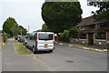
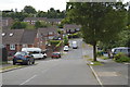
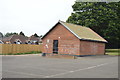
Image Listing (27 Images Found)
Images are licensed for reuse under creativecommons.org/licenses/by-sa/2.0
Image
Details
Distance

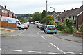
7
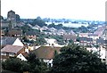
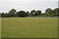
Terriers, High Wycombe (1973)
View from RGS High Wycombe. The church of St Francis of Assisi (on the left) was built in 1930. See http://www.terrierschurch.org.uk/ for more detail.
Image: © Stanley Howe
Taken: Unknown
0.12 miles