IMAGES TAKEN NEAR TO
Amersham Hill, HIGH WYCOMBE, HP13 6PB
Introduction
This page details the photographs taken nearby to Amersham Hill, HP13 6PB by members of the Geograph project.
The Geograph project started in 2005 with the aim of publishing, organising and preserving representative images for every square kilometre of Great Britain, Ireland and the Isle of Man.

There are currently over 7.5m images from over14,400 individuals and you can help contribute to the project by visiting https://www.geograph.org.uk
Image Map
Images are licensed for reuse under creativecommons.org/licenses/by-sa/2.0
Notes
- Clicking on the map will re-center to the selected point.
- The higher the marker number, the further away the image location is from the centre of the postcode.
Image Listing (255 Images Found)
Images are licensed for reuse under creativecommons.org/licenses/by-sa/2.0
Image
Details
Distance
3
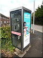
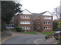
KX100 Telephone Box in Priory Road, High Wycombe
This telephone box is located in Priory Road near the A404 Amersham Hill. The photo shows the payphone inside it and an advertisement on its side. Edgecote House flats can be seen to the left of the photo.
Image: © David Hillas
Taken: 4 May 2021
0.01 miles
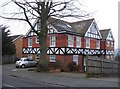
4
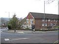
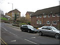
Road junction
Corner of Amersham Hill and Priory Road.
Image: © Mr Ignavy
Taken: 1 Jan 2009
0.02 miles
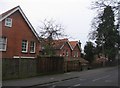
7
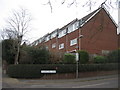
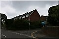
Malmers Well Road
At the junction with Priory Road.
Image: © Mr Ignavy
Taken: 1 Jan 2009
0.03 miles