IMAGES TAKEN NEAR TO
Jubilee Road, HIGH WYCOMBE, HP13 5TW
Introduction
This page details the photographs taken nearby to Jubilee Road, HP13 5TW by members of the Geograph project.
The Geograph project started in 2005 with the aim of publishing, organising and preserving representative images for every square kilometre of Great Britain, Ireland and the Isle of Man.

There are currently over 7.5m images from over14,400 individuals and you can help contribute to the project by visiting https://www.geograph.org.uk
Image Map (Loading...)


Getting Data...Please wait
Leaflet Map data © OpenStreetMap
Images are licensed for reuse under creativecommons.org/licenses/by-sa/2.0
Notes
- Clicking on the map will re-center to the selected point.
- The higher the marker number, the further away the image location is from the centre of the postcode.
Image Listing (21 Images Found)
Images are licensed for reuse under creativecommons.org/licenses/by-sa/2.0
Image
Details
Distance
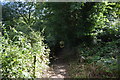
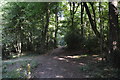
4
Public footpath near to the top of Little Tinker's Wood, Downley
Image: © Humphrey Bolton
Taken: 29 Jan 2022
0.15 miles
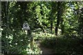
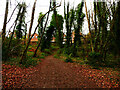
10

Farmland, Hughenden
In a small valley beside Little Tinker's Wood. Rooftops in Littleworth road in Downley can just be seen.
Image: © Andrew Smith
Taken: 23 Mar 2008
0.18 miles