IMAGES TAKEN NEAR TO
Hithercroft Road, HIGH WYCOMBE, HP13 5RF
Introduction
This page details the photographs taken nearby to Hithercroft Road, HP13 5RF by members of the Geograph project.
The Geograph project started in 2005 with the aim of publishing, organising and preserving representative images for every square kilometre of Great Britain, Ireland and the Isle of Man.

There are currently over 7.5m images from over14,400 individuals and you can help contribute to the project by visiting https://www.geograph.org.uk
Image Map
Images are licensed for reuse under creativecommons.org/licenses/by-sa/2.0
Notes
- Clicking on the map will re-center to the selected point.
- The higher the marker number, the further away the image location is from the centre of the postcode.
Image Listing (35 Images Found)
Images are licensed for reuse under creativecommons.org/licenses/by-sa/2.0
Image
Details
Distance
9
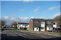
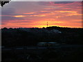
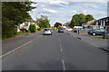
Hithercroft Road, High Wycombe
On top of a ridge overlooking the Wye valley, these northern suburbs are a bit of a climb from the town centre.
Image: © Des Blenkinsopp
Taken: 25 Jan 2018
0.09 miles