IMAGES TAKEN NEAR TO
Soane Walk, HIGH WYCOMBE, HP13 5AS
Introduction
This page details the photographs taken nearby to Soane Walk, HP13 5AS by members of the Geograph project.
The Geograph project started in 2005 with the aim of publishing, organising and preserving representative images for every square kilometre of Great Britain, Ireland and the Isle of Man.

There are currently over 7.5m images from over14,400 individuals and you can help contribute to the project by visiting https://www.geograph.org.uk
Image Map
Images are licensed for reuse under creativecommons.org/licenses/by-sa/2.0
Notes
- Clicking on the map will re-center to the selected point.
- The higher the marker number, the further away the image location is from the centre of the postcode.
Image Listing (79 Images Found)
Images are licensed for reuse under creativecommons.org/licenses/by-sa/2.0
Image
Details
Distance
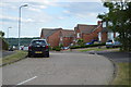
9
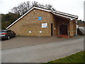
Kingdom Hall of Jehovah's Witnesses, High Wycombe
Situated in Bellfield Road HP13 5HP, this Kingdom Hall has midweek meetings on Wednesdays and Thursdays at 7.15pm, and weekend meetings on Sundays at 10.00am and 2.00pm. The blue "jw.org" notice on the building refers to their website.
Image: © David Hillas
Taken: 16 Mar 2017
0.12 miles
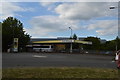
10
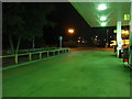
High Wycombe : Morrisons Petrol Station
From the petrol pump.
Image: © Lewis Clarke
Taken: 9 Oct 2016
0.12 miles