IMAGES TAKEN NEAR TO
Amersham Road, HIGH WYCOMBE, HP13 5AA

Introduction

This page details the photographs taken nearby to Amersham Road, HP13 5AA by members of the Geograph project.

The Geograph project started in 2005 with the aim of publishing, organising and preserving representative images for every square kilometre of Great Britain, Ireland and the Isle of Man.

There are currently over 7.5m images from over14,400 individuals and you can help contribute to the project by visiting https://www.geograph.org.uk

Image Map


Images are licensed for reuse under creativecommons.org/licenses/by-sa/2.0
Notes
  • Clicking on the map will re-center to the selected point.
  • The higher the marker number, the further away the image location is from the centre of the postcode.

Image Listing (39 Images Found)

Images are licensed for reuse under creativecommons.org/licenses/by-sa/2.0
  • ...
Image
Details
Distance
1
Amersham Rd, A404
Image: © N Chadwick Taken: 23 Jun 2018
0.02 miles
2
Amersham Rd, A404
Image: © N Chadwick Taken: 23 Jun 2018
0.04 miles
3
Amersham Rd, Arnison Rd junction
Image: © N Chadwick Taken: 23 Jun 2018
0.05 miles
4
The Hamptons
Image: © N Chadwick Taken: 23 Jun 2018
0.05 miles
5
Windsor Drive
Image: © N Chadwick Taken: 23 Jun 2018
0.07 miles
6
RGS Clock Tower
Image: © Stanley Howe Taken: Unknown
0.07 miles
7
Amersham Rd
Image: © N Chadwick Taken: 23 Jun 2018
0.07 miles
8
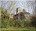
St Francis of Assisi Church and Vicarage
Not an easy church to do justice to in a photo due to surrounding trees and buildings. It is best appreciated from some distance away where the hilltop site makes it more of a landmark. Designed by Sir Giles Gilbert Scott and built in 1930.
Image: © Des Blenkinsopp Taken: 25 Jan 2018
0.08 miles
9
Chadwick Street, High Wycombe
Suburban houses at the junction with Tower Street.
Image: © Andrew Smith Taken: 5 Mar 2017
0.09 miles
10
Arnison Avenue
Image: © N Chadwick Taken: 23 Jun 2018
0.09 miles
  • ...