IMAGES TAKEN NEAR TO
Cressex Road, HIGH WYCOMBE, HP12 4UD
Introduction
This page details the photographs taken nearby to Cressex Road, HP12 4UD by members of the Geograph project.
The Geograph project started in 2005 with the aim of publishing, organising and preserving representative images for every square kilometre of Great Britain, Ireland and the Isle of Man.

There are currently over 7.5m images from over14,400 individuals and you can help contribute to the project by visiting https://www.geograph.org.uk
Image Map (Loading...)


Getting Data...Please wait
Leaflet Map data © OpenStreetMap
Images are licensed for reuse under creativecommons.org/licenses/by-sa/2.0
Notes
- Clicking on the map will re-center to the selected point.
- The higher the marker number, the further away the image location is from the centre of the postcode.
Image Listing (11 Images Found)
Images are licensed for reuse under creativecommons.org/licenses/by-sa/2.0
Image
Details
Distance
1
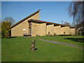
High Wycombe: Church of St Birinus and St John
This new church, in the Booker area of High Wycombe, is one of a small select group dedicated to St Birinus. St Birinus was the first Bishop of Dorchester and known as the Apostle to the West Saxons. He died in 649 and his feast day is 4 September. The church is on Sycamore Road off Cressex Road, and its website is here http://www.banjos.org.uk/
Update September 2020
It is evident from StreetView that this Church had already been demolished by May 2012, and a new church, now of Christ the Servant King, was being constructed on the site.
Image: © Nigel Cox
Taken: 19 Mar 2011
0.05 miles
4
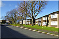
Flats on Havenfield Road, High Wycombe
Image: © Robin Webster
Taken: 23 Nov 2017
0.15 miles
5
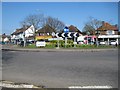
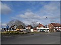
High Wycombe: Cressex Road Roundabout
A fine collection of daffodils adorn the centre of this roundabout on the Cressex Road at its junction with the A4010 John Hall Way.
Image: © Nigel Cox
Taken: 19 Mar 2011
0.15 miles
6
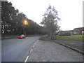
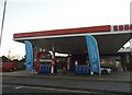
John Hall Way, Booker
I haven't been able to find out who John and Nancy Hall were yet but clearly an eminent local couple.
Image: © David Howard
Taken: 11 Feb 2018
0.21 miles
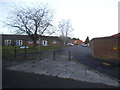
8
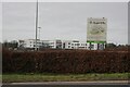
Cressex Community School
A new school built under the Building Schools for the Future (BSF) scheme.
Image: © Bill Boaden
Taken: 27 Jan 2024
0.23 miles
10
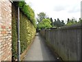
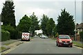
High Wycombe: Footpath in Cressex (1)
The hilly ground south of High Wycombe was criss-crossed with several public footpaths long before the houses and factories arrived. However when they were built the old footpath routes were kept and this is one running between the houses on New Road and heading towards the industrial estate on Halifax Road.
Image: © Nigel Cox
Taken: 25 Jul 2015
0.25 miles