IMAGES TAKEN NEAR TO
Rosemary Close, HIGH WYCOMBE, HP12 4AG
Introduction
This page details the photographs taken nearby to Rosemary Close, HP12 4AG by members of the Geograph project.
The Geograph project started in 2005 with the aim of publishing, organising and preserving representative images for every square kilometre of Great Britain, Ireland and the Isle of Man.

There are currently over 7.5m images from over14,400 individuals and you can help contribute to the project by visiting https://www.geograph.org.uk
Image Map
Images are licensed for reuse under creativecommons.org/licenses/by-sa/2.0
Notes
- Clicking on the map will re-center to the selected point.
- The higher the marker number, the further away the image location is from the centre of the postcode.
Image Listing (12 Images Found)
Images are licensed for reuse under creativecommons.org/licenses/by-sa/2.0
Image
Details
Distance
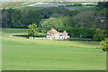
1
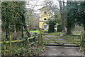
Park Farm
This rather ostentatious to be a farmhouse, but it is at the end of Park Farm Avenue, and within the curtilage of West Wycombe Park. So, just maybe.
Image: © Graham Horn
Taken: 29 Jan 2012
0.06 miles
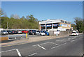
2
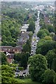
High Wycombe - West Wycombe Road
A straight section of the A40 seen here from the Dashwood Mausoleum on West Wycombe Hill.
Image: © Colin Smith
Taken: 26 Jul 2022
0.07 miles
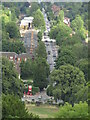
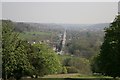
4
High Street, West Wycombe
An ambulance, with blue flashing lights, can be seen mid-way down the road. In the foreground the Gulf garage is displaying petrol and diesel prices at £134.9 and £138.9
This view is from the mausoleum on West Wycombe hill looking down on the village.
Image: © Dave Hitchborne
Taken: 15 Jun 2013
0.17 miles
6
Sawmill House
Part of West Wycombe Park, built in the 18th century as a working sawmill but designed like a chateau to fit in with the extravagance of the rest of the estate buildings.
This is maximum zoom on the little camera, so it's not as sharp as it might be.
Image: © Des Blenkinsopp
Taken: 2 May 2017
0.18 miles
7
West Wycombe
Looking southeast along the A40 from the hill above Hellfire Caves.
Image: © Brendan and Ruth McCartney
Taken: 21 Apr 2005
0.18 miles
9
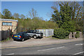
Footpath leaving West Wycombe Road
The footpath crosses the railway to get to the north western suburbs of High Wycombe.
Image: © Bill Boaden
Taken: 20 Apr 2018
0.19 miles
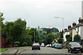
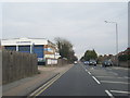
10
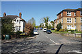
Beechwood Road
A residential road squashed into a small space on the western side of High Wycombe.
Image: © Bill Boaden
Taken: 20 Apr 2018
0.21 miles