IMAGES TAKEN NEAR TO
Brambleside, HIGH WYCOMBE, HP11 1JE
Introduction
This page details the photographs taken nearby to Brambleside, HP11 1JE by members of the Geograph project.
The Geograph project started in 2005 with the aim of publishing, organising and preserving representative images for every square kilometre of Great Britain, Ireland and the Isle of Man.

There are currently over 7.5m images from over14,400 individuals and you can help contribute to the project by visiting https://www.geograph.org.uk
Image Map
Images are licensed for reuse under creativecommons.org/licenses/by-sa/2.0
Notes
- Clicking on the map will re-center to the selected point.
- The higher the marker number, the further away the image location is from the centre of the postcode.
Image Listing (18 Images Found)
Images are licensed for reuse under creativecommons.org/licenses/by-sa/2.0
Image
Details
Distance
3
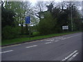
A40 London Road, High Wycombe
The bus lane is only for weekday peak periods.
Image: © Robin Webster
Taken: 9 Jun 2019
0.11 miles
4
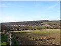
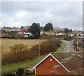
View from Hammersley Lane
Looking southwards. King's Mead is the expanse of grass in the valley. Fennell's Wood is on the hillside beyond.
Image: © Andrew Smith
Taken: 6 Apr 2006
0.14 miles
5

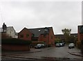
Shell petrol station on London Road, Wycombe Marsh
Image: © David Howard
Taken: 17 Feb 2022
0.16 miles
6
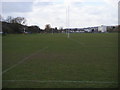
Rugby pitches on King's Mead
Rugby pitches on King's Mead Wycombe Marsh
Image: © Shaun Ferguson
Taken: 7 Mar 2008
0.17 miles
7
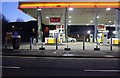
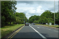
Shell petrol station on London Road, Wycombe Marsh
Image: © David Howard
Taken: 12 Jan 2020
0.18 miles
8
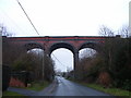
Viaduct over Rayners Avenue, High Wycombe
Carries the Chiltern Line between Beaconsfield and High Wycombe.
Image: © Andrew Smith
Taken: 7 Jan 2006
0.20 miles
9
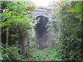
Loudwater: Magpie Lane railway bridge
Something of the jungle in this - maybe the misty morning complemented by the creepers hanging down in front of the bridge. Anyway this high bridge over a footpath at the end of Magpie Lane demonstrates the extent of the civil engineering works necessary for the former Great Western and Great Central Joint Railway between High Wycombe and Beaconsfield to be built through this part of the Chilterns.
Image: © Nigel Cox
Taken: 11 Oct 2007
0.20 miles